
 English
 Français

Hankelow
Hankelow is a village and civil parish in the unitary authority of Cheshire East and the ceremonial county of Cheshire, England. The village lies on the A529, around 1.25 miles (2.0 km) north east of Audlem and 4.5 miles (7.2 km) south of Nantwich. The civil parish has an area 369 hectares (910 acres) and also includes the small settlement of The Dell and part of Corbrook, with a total population of just over 260 in 2011. Nearby villages include Aston, Broomhall Green, Sound, Hatherton and Buerton in Cheshire and Woore in Shropshire. Hankelow is first documented in the 13th century, and the village historically had a school, two chapels, two public houses, a water mill, post office, shop and other facilities. Only a Methodist chapel – also used as a community centre – remained open in 2020. Two buildings are listed at grade II*: the 16th-century Ball Farmhouse and the 18th-century Hankelow Hall. Outside the village, the civil parish is predominantly rural and agricultural. The River Weaver runs in the west of the parish, and there is a small area of probable ancient woodland in the north east.
Lieux à Proximité Voir Menu


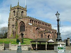
Audlem

Buerton (Cheshire East)
