Location Image

Round Loch of Glenhead

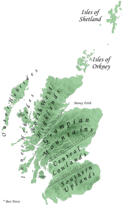
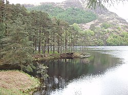
The Round Loch of Glenhead is a small upland single basin loch in Dumfries and Galloway. It is situated within Galloway Forest Park to the west of the hill Craiglee. It forms a pair with the nearby Long Loch of Glenhead. Both lochs are of similar sizes and each have a small island. The two lochs are separated from Loch Valley and Loch Naroch to the north by the Rig of the Jarkness. The loch is drained to the southwest by Round Loch Burn, which after joining into Glenhead Burn flows into Loch Trool. The catchment of the loch, which receives around 2.3 m of precipitation per year, is 90 hectares of the slopes of Craiglee and some flatter areas nearer the loch. These are characterised by soils varying from thick peat to bare granite and tonalite. The unafforested catchment has vegetation typical of moorland blanket mires. The area is grazed by cattle in the summers only; having previously supported sheep, with periodic peat burning. The loch has suffered bady from the effects of acidification. As of 2012 the loch had started to recover from this but was still chronically affected, with nitrate and sulphate levels also high. Over the period of July 2013 to December 2014 the pH varied from 4.1 to 6 and the dissolved oxygen ranged from 8.7 to 12.7 mg/L. The lake and its catchment are part of the Merrick Kells Site of Special Scientific Interest and Special Area of Conservation and the Silver Flowe-Merrick Kells UNESCO biosphere reserve The loch is monitored since 2005 on an intermittent basis by the (now) United Kingdom Lake Ecological Observatory Network and the Upland Waters Monitoring Network (the United Kingdom Acid Waters Monitoring Network from 1988 to 2013). As of 2011 it was the 'most fully equipped site for monitoring upland water quality and freshwater biodiversity in the UK' The loch is characterised as oligotrophic and polymictic The main plant species present in the catchment include moor grass, heathers including common heather, bracken and sedge and includes other species commonly associated with upland blanket mires such as moor matgrass and potentilla.

Lieux à Proximité Voir Menu
Location Image
1.3 km

Loch Valley

Le loch Valley est un plan d'eau douce situé dans le Galloway Forest Park à l'est de Buchan Hill, au nord du Rig of the Jarkness et sud-ouest de Craignaw. Il se jette via la Gairland Burn dans le loch Trool. Le loch, qui a un bassin entièrement taillé dans le granite de Loch Doon, est oligotrophique et, a souffert de l'acidification progressive depuis les années 1800 conduisant à la disparition de la population d'origine de la truite brune. Il a retrouvé une certaine normalité, avec l'augmentation lente de son pH, passé de 4,4 en 1978 à 5,2 en 2003. Entre 1983 et 2003, le niveau de carbone organique dissous du loch a augmenté, et le loch a un taux d'accumulation de sédiments d'environ 0.01 g cm-2 an-1 de 1850 à 1975.
Location Image
3.2 km

Southern Uplands

Les Southern Uplands sont un massif montagneux d'environ 220 km de long situé dans le Sud de l'Écosse et pour une petite partie dans le Nord de l'Angleterre. C'est la plus méridionale des trois principales zones géographiques de l'Écosse continentale (les deux autres étant les Basses-Terres centrales et les Highlands). Le terme est utilisé à la fois pour décrire la région géographique et en désigner collectivement les différentes chaînes de collines et de montagnes. La région est essentiellement rurale et agricole. Ces hautes terres sont en partie boisées et contiennent de nombreuses zones de landes ouvertes. Elles abritent une faune et une flore très variées.
Location Image
3.4 km

Parc forestier de Galloway

Galloway Forest Park est un parc forestier situé dans la région de Dumfries and Galloway en Ecosse. Avec ses 774 km², elle passe pour être la plus grande forêt du Royaume-Uni. Le parc a été enregistré Dark Sky Park (Réserve de ciel étoilé) en novembre 2009, étant le premier site au Royaume-Uni à être désigné.
Location Image
3.9 km

Loch Trool

Le loch Trool est un plan d'eau dans la région de Galloway, au sud-ouest de l'Écosse. Il se situe dans la vallée de Glen Trool. Il est la source de la Water of Trool qui se jette dans la Water of Minnoch et la rivière Cree. Il a été le lieu, en 1307, de la bataille de Glen Trool.
Location Image
5.6 km

Merrick (montagne)

Le Merrick, Mearaig en gallois, est une montagne du Royaume-Uni située en Écosse et constituant le point culminant des Galloway Hills et plus largement des Southern Uplands, avec 843 mètres d'altitude.