Blyth Power Station (also known as Cambois Power Station) refers to a pair of now demolished coal-fired power stations, which were located on the Northumberland coast in North East England. The two stations were built alongside each other on a site near Cambois in Northumberland, on the northern bank of the River Blyth, between its tidal estuary and the North Sea. The stations took their name from the town of Blyth on the opposite bank of the estuary. Blyth A Power Station was built and opened first but had a smaller generating capacity than its sister station, Blyth B Power Station, which was built to its west four years later. The power stations' four large chimneys were a landmark of the Northumberland skyline for over 40 years; the A Station's two chimneys each stood at 140 metres (460 ft); the B Station's two chimneys were taller, at 170 metres (560 ft) each. Construction of the B Station began shortly after the A station was completed. The stations were built during a period in which there were great advances in power station technology, and in the scale of production, which led to them having a variety of intermediate generator set sizes along with a mix of design styles. Blyth A had a generating capacity of 480 megawatts (MW) and the B Station 1,250 MW. Their combined capacity of 1,730 MW briefly made Blyth Power Station the largest electricity generation site in England, until Ferrybridge C Power Station came into full operation in 1966. The stations were capable of generating enough electricity to power 300,000 homes. The A Station first generated electricity in 1958, a year after the creation of the Central Electricity Generating Board, and the stations operated until 2001. They were operated by the successors of the CEGB, including National Power, following the privatisation of the UK's power industry. After their closure in 2001, the stations were demolished over the course of two years, ending with the demolition of the stations' chimneys on 7 December 2003. RWE Npower proposed the construction of a clean coal-fired power station on the site, but the plans were postponed. In December 2020, the site was confirmed as the location for a new automotive battery manufacturing plant.

Lieux à Proximité Voir Menu
Location Image
1.7 km

Blyth Valley

La Blyth Valley est un ancien district non-métropolitain et un Borough du Northumberland, en Angleterre. Il est situé au bord de la mer du Nord et jouxte le comté de Tyne and Wear. Il a été créé le 1er avril 1974 par le Local Government Act de 1972 et est issu de la fusion du borough de Blyth, du district urbain de Seaton Valley, et d'une partie du borough de Whitley Bay. Il comprend notamment les villes de Blyth, où siège le conseil de district, et Cramlington, et les localités de Seaton Delaval et Seaton Sluice. Le conseil de district a été aboli par les changements structurels de l'administration locale anglaise de 2009, entrés en vigueur le 1er avril 2009. Ses pouvoirs ont été transférés au conseil de comté du Northumberland, agissant en tant qu'autorité unitaire.
Location Image
2.0 km

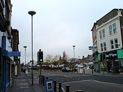
Blyth (Northumberland)

Blyth est une ville du sud du comté de Northumberland en Angleterre. Elle se trouve à une vingtaine de kilomètres de Newcastle upon Tyne. Le développement de la ville moderne a commencé dans le premier quart du XVIIIe siècle. Les principales industries qui ont contribué à la prospérité de la ville étaient l'extraction du charbon et la construction navale. Ces industries ont largement disparu, mais le port continue de prospérer. Son cartulaire a été conservé. Les importants personnages de la région au Moyen Âge s'y trouvent cités. Parmi eux, on note la présence de William de Wendeval dont le nom est sur la liste des inspirateurs du personnage du Shérif de Nottingham, dans la légende de Robin des Bois. Elle possède un ancien phare construit en 1788 connu sous le nom de High Light.
Location Image
2.6 km

Phare de Blyth High

Le phare de Blyth High est un ancien phare situé dans la ville de Blyth, dans le sud du comté du Northumberland en Angleterre. Il est maintenant protégé en tant que monument classé du Royaume-Uni de Grade II en 1987.
Location Image
4.2 km

Wansbeck

Wansbeck est un ancien district non-métropolitain du Northumberland, en Angleterre. Il doit son nom à la rivière Wansbeck. Il a été créé le 1er avril 1974 par le Local Government Act de 1972 et est issu de la fusion des districts urbains de Ashington, Bedlingtonshire et Newbiggin-by-the-Sea. Ses principales villes sont Ashington, où siégeait le conseil de district, Bedlington et Newbiggin-by-the-Sea. Il se trouve au bord de la mer du Nord, au nord de la conurbation de Tyneside. Le conseil de district a été aboli par les changements structurels de l'administration locale anglaise de 2009, entrés en vigueur le 1er avril 2009. Ses pouvoirs ont été transférés au conseil de comté du Northumberland, agissant en tant qu'autorité unitaire.
Location Image
4.6 km

Choppington

Choppington est une paroisse civile et un village du Northumberland, en Angleterre. La population de la paroisse civile au recensement de 2011 était de 9 787 habitants.