
 English
 Français

Central Park is a tram stop on the Oldham and Rochdale Line (ORL) of Greater Manchester's light rail Metrolink system. It opened to passengers on 13 June 2012 as part of Phase 3a of Metrolink's expansion, and is located in the Newton Heath area of Manchester, England. The station was constructed in 2005 but was unused until 2012. The station serves the Central Park area, an urban renewal development project in north-east Manchester which includes the new headquarters of Greater Manchester Police and the Sharp Project. The station forms part of The Gateway, a £36.5 million transport interchange which will include local bus services as well as the Metrolink tram stop.
Lieux à Proximité Voir Menu

224 m
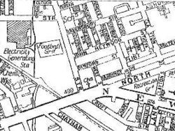
North Road (stade)
North Road était un stade de football et de cricket à Manchester, Angleterre. Il a été le premier terrain à domicile du Manchester United Football Club – alors connu sous le nom de Newton Heath Lancashire & Yorkshire Railway Football Club – de la fondation du club en 1878 à 1893, lorsqu'il a déménagé pour le nouveau terrain de Bank Street, situé à Clayton (en).


1.9 km
Vélodrome de Manchester
Le vélodrome de Manchester est un vélodrome situé à Manchester, en Angleterre.
1.9 km
National Squash Centre
Le National Squash Centre est une salle de squash située dans le quartier d'Eastlands, à Manchester, en Angleterre et qui a été construit à l'occasion des Jeux du Commonwealth de 2002.
Le National Squash Centre fait partie du complexe Sportcity (en).
1.9 km
Bank Street (stade)
Bank Street, aussi connu sous le nom de Bank Lane était un stade polyvalent à Manchester, Angleterre. Aujourd’hui, le Vélodrome de Manchester se situe sur ce lieu, tout près de l’Etihad Stadium.