
 English
 Français

Stand, North Lanarkshire
Stand is a hamlet in North Lanarkshire, Scotland situated on the A73 near Airdrie. Its Ordnance Survey grid reference is NS7668.
The village appeared on a map by Timothy Pont, published in 1596. It is near the top right of the map near the Black Loch. Stand is also shown on another map by Roy c1754. The etymology of the name is uncertain although a horse stop or stabling point has been suggested. It is between the Fleming estates at Biggar and Cumbernauld.
Lieux à Proximité Voir Menu

977 m

2.6 km

2.9 km
Broomfield Park
Le Broomfield Park est un ancien stade de football construit en 1892 et fermé en 1994, et situé à Airdrie, en Écosse.
3.2 km
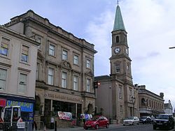
Airdrie (Écosse)
Airdrie est une ville écossaise située dans le North Lanarkshire. Elle se trouve à 19 km à l’est de Glasgow à une altitude de 130 mètres. La ville forme avec sa voisine Coatbridge, la région des Monklands. En 2006 sa population s’élevait à 36 326 habitants. Les villages de Chapelhall, Calderbank, Glenmavis, Greengairs, Plains et Caldercruix sont des satellites d’Airdrie.

3.4 km