English
 Français

Greater Manchester
Greater Manchester is a metropolitan and ceremonial county in North West England. It borders Lancashire to the north, West Yorkshire and Derbyshire to the east, Cheshire to the south, and Merseyside to the west. Its largest settlement is the city of Manchester. The county has an area of 1,276 km2 (493 sq mi) and is highly urbanised, with an estimated population of 3,009,664 in 2024. Manchester is located in the centre of the county, with the city of Salford immediately adjacent to the west. Other large settlements include Rochdale in the north-east, Stockport in the south-east, Sale in the south-west, Wigan in the far north-west, and Bolton in the north-west. The majority of the county's settlements are part of the Greater Manchester Built-up Area, which extends into Cheshire and Merseyside and is the second most populous urban area in the United Kingdom. For local government purposes the county comprises ten metropolitan boroughs: Manchester, Salford, Bolton, Bury, Oldham, Rochdale, Stockport, Tameside, Trafford and Wigan. The borough councils collaborate through the Greater Manchester Combined Authority. Greater Manchester was created on 1 April 1974 from parts of north-east Cheshire, south-east Lancashire, and a small part of the West Riding of Yorkshire. The centre and south-west of Greater Manchester are lowlands, similar to the West Lancashire Coastal Plain to the north-west and the Cheshire Plain to the south-west. The north and east are part of the Pennines: the West Pennine Moors in the northwest, the South Pennines in the northeast and the Peak District in the east. Most of the county's rivers rise in the Pennines and are tributaries of the Mersey and Irwell, the latter of which is itself a tributary of the Mersey. The county is connected to the Mersey Estuary by the Manchester Ship Canal, which for its entire length within Greater Manchester consists of canalised sections of the Mersey and Irwell. What is now Greater Manchester was largely rural until the Industrial Revolution, when the region underwent rapid industrialisation. The area's towns and cities became major centres for the manufacture of cotton textiles, aided by the exploitation of the Lancashire coalfield. The region was also an engineering and scientific centre, leading to achievements such as the first inter-city railway. Following deindustrialisation in the mid-20th century the county has emerged as a major centre for the service sector, media and digital industries. It is also recognised for its contributions to guitar and dance music, and for its football teams.
Lieux à Proximité Voir Menu

Grand Manchester

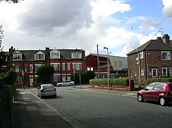
Pendlebury
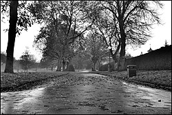
Victoria Park (Swinton)