
 English
 Français

Throckley
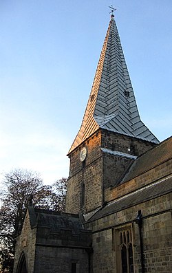
Throckley is a village in the Newcastle upon Tyne district, in the county of Tyne and Wear, England, approximately 7 miles (11 km) west of Newcastle city centre. Hadrian's Wall passed through the village, its course traced by the village's main road, Hexham Road. Throckley lies within the historic county of Northumberland. Throckley was a colliery village, being adjacent to Throckley Colliery, but with the decline in the coal-mining industry the village has become more urbanised. The English industrialist, philanthropist and historical Lord Mayor of Newcastle Upon Tyne, Sir William Haswell Stephenson was born in Throckley and lived in the manor house Throckley Hall with his wife and two children, located in the South West of the village. Stephenson owned much of the land surrounding Throckley and the coal pits. He was Mayor of Newcastle upon Tyne in 1875, 1884, and 1894 and Lord Mayor in 1902, 1909, 1910, and 1911. Other notable residents include William Brown, a consulting engineer in the 18th century, and part owner of Throckley Colliery, who was responsible for the construction of many colliery waggonways throughout the North East of England. As a youngster, George Stephenson worked on Dewley farm which lies to the north of the A69. Throckley neighbours the villages of Newburn, Walbottle, Blucher, and across the border in Northumberland, Heddon-on-the-Wall. The village expanded with a number of new housing estates having been developed since the mid-2000s. Amenities include a supermarket, car parts shop, a number of hair salons, social clubs and a working men's club, three care homes for the elderly, two churches, a solarium, funeral parlour, an optometrist, medical surgery, a range of newsagents, a chemist, a Masonic hall, and a primary school (Throckley Primary School). Throckley's economy is also boosted by the presence of an industrial estate, home to Throckley Brickworks and Warmseal Windows.
Lieux à Proximité Voir Menu

Walbottle

Heddon-on-the-Wall
Ryton (Tyne and Wear)

Mithraeum de Rudchester
