
 English
 Français

River Weaver
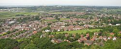
The River Weaver is a river, navigable in its lower reaches, running in a curving route anti-clockwise across west Cheshire, northern England. Improvements to the river to make it navigable were authorised in 1721 and the work, which included eleven locks, was completed in 1732. An unusual clause in the enabling act of Parliament, the River Weaver Navigation Act 1720 (7 Geo. 1. St. 1. c. 10), stipulated that profits should be given to the County of Cheshire for the improvement of roads and bridges, but the navigation was not initially profitable, and it was 1775 before the first payments were made. Trade continued to rise, and by 1845, over £500,000 had been given to the county. The major trade was salt. The arrival of the Trent and Mersey Canal at Anderton in 1773 was detrimental to the salt trade at first, but ultimately beneficial, as salt was tipped down chutes from the canal into barges on the river navigation. Access to the river was improved in 1810 by the Weston Canal, which provided a link to Weston Point, where boats could reach the River Mersey at most states of the tide, as the water was deeper. The navigation was completely reconstructed between 1870 and 1900, with the original locks being replaced by five much larger locks, capable of handling 1000-tonne coasters. With the opening of the Manchester Ship Canal, a new lock was constructed at Weston Marsh, which gave direct access to the ship canal without having to pass through the docks at Weston Point. All water from the river entered the canal nearby, and any surplus was released into the Mersey through the Weaver sluices, which were located just upstream of the junction. A notable feature is the Anderton Boat Lift, which is near Northwich, and links the Weaver with the Trent and Mersey Canal some 50 feet (15 m) above. It was opened in 1875, to allow canal boats to reach the Weaver, and although closed on safety grounds in 1983, it was refurbished and reopened in 2002. Many of the structures of the navigation are of historical importance, and are grade II listed. They include the Hayhurst swing bridge and Northwich Town bridge, which are believed to be the earliest swing bridges powered by electricity. Both have a sectional pontoon, which is immersed in the river and carries about 80 per cent of the weight of the bridge. Dutton Horse Bridge, which carries the towpath over the weir stream at Dutton, is one of the earliest surviving laminated timber structures. Dutton railway viaduct, which was built by Joseph Locke and George Stephenson for the Grand Junction Railway, is grade II* listed, and a civic celebration was held on its completion, as there had been no deaths and no serious injuries to the workers during its construction.
Lieux à Proximité Voir Menu
Frodsham
Runcorn

Phare de Hale Head

Halton (borough)
