English
 Français

County Durham
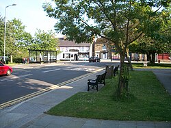
County Durham, or Durham, is a ceremonial county in North East England. The county borders Northumberland and Tyne and Wear to the north, the North Sea to the east, North Yorkshire to the south, and Cumbria to the west. The largest settlement is Darlington. The county has an area of 2,676 square kilometres (1,033 sq mi) and had a population of 894,025 in 2024. The centre and east of the county are more densely populated than the west, and the major settlements include Hartlepool on the south-east coast, Stockton-on-Tees in the south-east, Darlington in the south, and the city of Durham in the north-centre. Stockton-on-Tees is part of the Teesside conurbation, which extends into North Yorkshire. Barnard Castle is the largest town in the west of the county. For local government purposes the county comprises the unitary authority areas of County Durham, Darlington, Hartlepool, and part of Stockton-on-Tees. Durham County Council is part of the North East Combined Authority, and the councils of the other three areas are part of the Tees Valley Combined Authority. The part of Tyne and Wear south of the River Tyne was historically part of County Durham, and the part of Durham south of the River Tees was historically part of the North Riding of Yorkshire. The west of the county contains part of the North Pennines uplands, a national landscape. The hills are the source of the rivers Tees and Wear, which flow east and form the valleys of Teesdale and Weardale respectively. The east of the county is flatter, and the two rivers meander through it; the Tees forms the boundary with North Yorkshire in its lower reaches, and the Wear exits the county near Chester-le-Street in the north-east. The county's coast is characterised by tall limestone and dolomite cliffs and is a site of special scientific interest. What is now County Durham was on the border of Roman Britain, and contains survivals of this era at sites such as Binchester Roman Fort. In the Anglo-Saxon period the region was part of the Kingdom of Northumbria. In 995 the city of Durham was founded by monks seeking a place safe from Viking raids to house the relics of St Cuthbert. Durham Cathedral was rebuilt after the Norman Conquest, and together with Durham Castle is now a World Heritage Site. By the late Middle Ages the county was governed semi-independently by the bishops of Durham and was also a buffer zone between England and Scotland. County Durham became heavily industrialised in the nineteenth century, when many collieries opened on the Durham coalfield. The Stockton and Darlington Railway, the world's first public railway to use steam locomotives, opened in 1825. Most collieries closed during the last quarter of the twentieth century, but the county's coal mining heritage is remembered in the annual Durham Miners' Gala.
Lieux à Proximité Voir Menu

Durham (comté)

Witton-le-Wear

Château de Witton

Cockfield (Durham)