Ramsden Dock is one of the four docks which make up the Royal Port of Barrow in Barrow-in-Furness, England. It was constructed between 1872 and 1879 covering 162,000 square metres (1,740,000 sq ft) and named in honour of Sir James Ramsden; a founder of Barrow. Ramsden Dock splits into two parts in the south, the anchor basin and dock basin. Since the infilling of a section of Devonshire Dock in the 1980s, Ramsden Dock has been the only point of entry to Barrow's now enclosed port. Managed by Associated British Ports, Ramsden Dock is by far the busiest of the four dock in terms of cargo tonnage, handling shipments of limestone, sand, aggregates and granite. Ramsden Dock and the Royal Port of Barrow as a whole are highly involved in the energy sector and the nearby Rampside Gas Terminal, Sellafield nuclear facility and offshore windfarms. The port office is located adjacent to Ramsden Dock. Powerboat racing often takes place in Ramsden Dock, while a proposed redevelopment scheme of the area incorporates a watersports centre within the dock. Historically, Ramsden Dock was a major transportation hub with a dedicated railway station connected to a branch of the Furness Railway and a terminus of the Barrow-in-Furness Tramway. A passenger ferry terminal at the dock was utilised by the Isle of Man Steam Packet Company and Barrow Steam Navigation Company offering steamer services to the likes of Belfast and Douglas, Isle of Man. A rail line along the eastern perimeter of Ramsden Dock remains in use to this day with freight services to and from the dock.

Lieux à Proximité Voir Menu
Location Image
1.2 km

Barrow (île)

L'île Barrow est une ancienne île de la ville de Barrow-in-Furness, dans le comté de Cumbria en Angleterre. Originellement séparée de la Grande-Bretagne, elle a été reliée au continent en 1860. Elle est séparée de l'île de Walney par le détroit de Walney.
Location Image
1.2 km

Barrow-in-Furness (district)
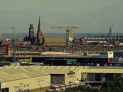
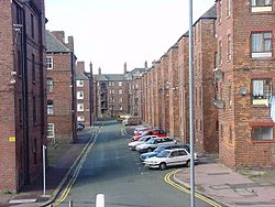
Barrow-in-Furness était un district non métropolitain de Cumbria, en Angleterre. Il avait le statut de borough. Barrow-in-Furness a été intégrée dans une nouvelle entité administrative. Aujourd'hui, maintenat cette zone fait partie du district unitaire de Westmorland and Furness, résultant d'une réorganisation territoriale visant à améliorer la gestion locale. Il portait le nom de sa principale ville, Barrow-in-Furness. Les autres principales villes du district sont Dalton-in-Furness, Roose et Askam-in-Furness. C'est le plus petit district du comté, et le plus densément peuplé. Le district etait créé le 1er avril 1974. Il etait issu de la fusion de l'ancien borough de Barrow-in-Furness et du district urbain de Dalton-in-Furness.
Location Image
1.2 km

Barrow-in-Furness

Barrow-in-Furness est une ville portuaire et industrielle de Cumbria, située dans le nord-ouest de l'Angleterre au Royaume-Uni. En 2011, Barrow-in-Furness avait une population de 55 489 habitants.
Location Image
1.7 km

Chenal Walney

Le chenal Walney (en anglais : Walney Channel) sépare l’île Walney du continent britannique. La partie nord du chenal s’ouvre sur l’estuaire du Duddon. Elle est à la fois la plus étroite et la moins profonde. La moitié sud du chenal est plus large, et elle est régulièrement draguée pour permettre aux navires d’accéder au port de Barrow-in-Furness. Cette moitié s’ouvre sur la baie de Morecambe. Le chenal est enjambé par le pont de Walney (officiellement Jubilee Bridge) achevé en 1908. En raison des besoins de la navigation, en particulier des activités du chantier naval Vickers, il a été construit comme un pont basculant.
Location Image
2.0 km

Pont de Walney

Le pont de Walney (en anglais : Walney Bridge), officiellement nommé Jubilee Bridge, est un pont basculant situé à Barrow-in-Furness, Cumbria, en Angleterre. Achevé en 1908, il enjambe le chenal Walney, et relie l’île Barrow à l’île Walney. La route nationale A590, qui a son terminus ouest sur Walney, passe sur le pont.