English
 Français

Nidd Valley Light Railway
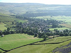
Nidd Valley Light Railway was a light railway in upper Nidderdale in the West Riding of Yorkshire, England. It was owned by Bradford Corporation Waterworks Department and the corporation also operated its public passenger services. Power & Traction Ltd of London obtained a Light Railway Order for the 6.5-mile (10.5 km) railway from Pateley Bridge to Lofthouse in 1900, but these powers were taken over by Bradford Corporation. A contract to build Angram Reservoir was awarded to John Best & Son in 1903, and he also won the contract to build the public railway and a 6.5-mile (10.5 km) private extension to the reservoir site. This was initially built to 3 ft (914 mm) gauge but was converted to standard gauge by 1907, when the public railway opened. Best had his own locomotives, and Bradford Corporation equipped the public railway with second hand locomotives and carriages from the Metropolitan Railway. The Angram Reservoir project was completed in 1916. The corporation had obtained powers to build another reservoir at Scar House in 1913, and in 1920 decided to proceed, using direct labour rather than a contractor. The railway was upgraded, with the purchase of new and second hand locomotives, a railmotor for the public services, and second hand carriages for the workmen's trains. Curves on the line above Lofthouse were eased, and a short tunnel was built. At its height, the corporation were running fourteen locomotives, three steam navvies and 19 or 20 steam cranes. The work was essentially completed by 1931, but filling of the reservoir did not begin until 1935 and the official opening was the following year. With the work complete, the railway was lifted, and a sale was held at Pateley Bridge. Scar Village, which at its peak had housed 1,135 people, of whom 780 worked on the project, was reduced to eight occupied houses by 1936, with seven pupils at the school. The railway workers were not entitled to a pension, but pensions were awarded to four men who had served for many years.
Lieux à Proximité Voir Menu


Grottes de Mossdale