
 English
 Français
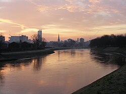
Bacup ( BAY-kəp, ) is a town in the Rossendale Borough in Lancashire, England, in the South Pennines close to Lancashire's boundaries with West Yorkshire and Greater Manchester. The town is in the Rossendale Valley and the upper Irwell Valley, 4 miles (6.4 km) east of Rawtenstall, 6 miles (9.7 km) north of Rochdale, and 7 miles (11 km) south of Burnley. At the 2011 Census, Bacup had a population of 13,323. Bacup emerged as a settlement following the Anglo-Saxon settlement of Britain in the Early Middle Ages. For centuries, it was a small and obscure centre of domestic flannel and woollen cloth production, and many of the original weavers' cottages survive today as listed buildings. Following the Industrial Revolution, Bacup became a mill town, growing up around the now covered over bridge crossing the River Irwell and the north–south / east-west crossroad at its centre. During that time its landscape became dominated by distinctive and large rectangular woollen and cotton mills. Bacup received a charter of incorporation in 1882, giving it municipal borough status and its own elected town government, consisting of a mayor, aldermen and councillors to oversee local affairs. In 1974, Bacup became part of the borough of Rossendale. Bacup's historic character, culture and festivities have encouraged the town to be seen as one of the best preserved mill towns in England. English Heritage has proclaimed Bacup town centre as a designated protected area for its special architectural qualities.
Lieux à Proximité Voir Menu

Bacup

Rue Elgin (Bacup)
Rossendale and Darwen
Irwell
