English
 Français
Tyldesley
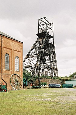
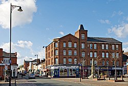
Tyldesley () is a market town in the Metropolitan Borough of Wigan in Greater Manchester, England. Within the boundaries of the historic county of Lancashire, it is north of Chat Moss near the foothills of the West Pennine Moors, eight miles (13 kilometres) southeast of Wigan and nine miles (14 kilometres) northwest of Manchester. At the United Kingdom Census 2001, the Tyldesley built-up area subdivision, excluding Shakerley, had a population of 16,142. The remains of a Roman road passing through the township on its ancient course between Coccium (Wigan) and Mamucium (Manchester) were evident during the 19th century. Following the Anglo-Saxon settlement of Britain, Tyldesley was part of the manor of Warrington, until the Norman Conquest of England, when the settlement constituted a township called Tyldesley-with-Shakerley in the ancient parish of Leigh. The factory system and textile manufacture during the Industrial Revolution triggered population growth and urbanisation, and by the early 20th century it was said that the mill town was "eminently characteristic of an industrial district whose natural features have been almost entirely swept away to give place to factories, iron foundries, and collieries". After industrial activity declined in the late 20th century, land reclamation and post-war residential developments have altered the landscape and encouraged economic activity along Elliott Street.
Nearby Places View Menu
Tyldesley

Atherton (Grand Manchester)

Astley (Grand Manchester)