
 English
 Français
Aballava or Aballaba (with the modern name of Burgh by Sands) was a Roman fort on Hadrian's Wall, between Petriana (Stanwix) to the east and Coggabata (Drumburgh) to the west. It is about one and a half miles south of the Solway Firth, and its purpose was to guard the south end of two important Solway fords, the Peat Wath and the Sandwath, which were also to become favourite routes for medieval border raiders. The name 'Aballava' probably comes from the British Celtic for '(apple) orchard'. The fort is five and a half miles west of Stanwix. The fort was an oblong, straddling the Wall, and measured 500 feet (150 m) north to south by 400 feet (120 m) east to west, occupying an area of 5 acres (20,000 m2). Only the location of the eastern wall is known for certain. It is believed that it was built over the site of turret 71b. There is a fortified border church on the site built almost entirely of Roman stones, and it is believed that this stands on the site of the principia of the fort. There was a vicus to the south-west of the fort, and it is believed that a cemetery existed to the south of the fort.
Lieux à Proximité Voir Menu

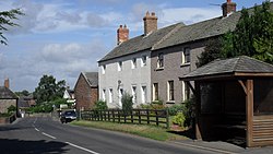
Burgh by Sands

Beaumont (Cumbria)

Kirkbampton

Rockcliffe (Cumbria)
