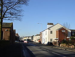
The Wheatsheaf is a public house at Mill Lane, St Helens, Merseyside WA9 4HN, England. It was built in 1936–1938 by the brewery Greenall Whitley & Co. Ltd of Warrington, to a design by the architect W. A. Hartley.

The building was Grade II listed in 2015 by Historic England as part of a drive to protect some of the country's best interwar pubs. The building was described as an example of "Brewers' Tudor", a type of Tudor Revival architecture. It is also included in CAMRA's National Inventory of Historic Pub Interiors. The pub was built as part of a reform movement to replace "drinking dens" with more civilized drinking. The granting of a licence for the new pub was conditional upon the surrender of the licences of three other public houses in the locality: the Crystal Palace, the Engine and Tender and the Wheatsheaf Hotel. There is a bowling green outside.

1. See also

For similarly-named pubs in London see

The Wheatsheaf, Fitzrovia The Wheatsheaf, Southwark

1. References


1. External links

http://www.thewheaty.com/

Lieux à Proximité Voir Menu
Location Image
1.3 km

Bold (Royaume-Uni)

Bold est une paroisse civile du Merseyside, en Angleterre.
Location Image
2.4 km

Totally Wicked Stadium

Le Totally Wicked Stadium est un stade de rugby à XIII situé à St Helens (Angleterre), dont la construction est terminée en 2011. D'une capacité de 18 000 places, il accueille les Saints de St Helens, club de Super League, et la réserve du Liverpool FC. Le premier match de rugby à XIII a été joué le 20 janvier 2012 et a opposé St Helens aux Widnes Vikings. Une statue en bronze de l'ancien capitaine du club, Keiron Cunningham, se trouve au-dessus de l'entrée principale.
Location Image
3.3 km

Burtonwood

Burtonwood and Westbrook est une civil parish (paroisse civile) située dans la lointaine banlieue de Warrington dans le Cheshire, en Angleterre. Elle fait historiquement partie du Lancashire. La ville est connue pour la RAF Burtonwood, une base militaire de la Royal Air Force. La paroisse civile inclut également Westbrook. Au recensement de 2001, elle comptait 11 265 habitants.
Location Image
3.7 km

District métropolitain de St Helens

Le district métropolitain de St Helens (en anglais : Metropolitan Borough of St Helens) est un district métropolitain du Merseyside. Il porte le nom de sa principale ville St Helens et comprend les localités de Newton-le-Willows, Earlestown, Haydock, Rainhill, Eccleston, Clock Face, Billinge et Rainford. Le district est créé le 1er avril 1974, par le Local Government Act 1972. Il est issu de la fusion de l'ancien district de Saint Helens, avec les districts urbains de Hoydock, Newton-le-Willows et Rainford, des portions des districts urbains de Billinge-and-Winstanley et Ashton-in-Makerfield, ainsi qu'une partie du district rural de Whiston.
Location Image
3.7 km

Rainhill

Rainhill est un village du district métropolitain de Saint Helens, dans le Merseyside, en Angleterre. Il est connu pour avoir accueilli le premier pont construit en biais au-dessus d'une voie de chemin de fer par George Stephenson.