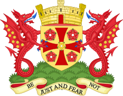
The City of Carlisle ( kar-LYLE, locally KAR-lyle) was a local government district of Cumbria, England, with the status of a city. It was named after its largest settlement, Carlisle, but covered a far larger area which included the towns of Brampton and Longtown, as well as outlying villages including Dalston, Scotby and Wetheral. In 2011 the district had a population of 107,524, and an area of 1,039.97 square kilometres (402 sq mi). The district boundaries were set as part of the provisions of the Local Government Act 1972, and covered an amalgamation of two former local government districts, the City and County Borough of Carlisle and the Border Rural District of Cumberland. The district shared a border with Scotland (to the north), and was bounded on the southwest by the borough of Allerdale, and on the south by the district of Eden. The county of Northumberland was to the east. Although the district boundaries dated to the 20th century, the city traces its origins to a 1st-century Roman outpost associated with Hadrian's Wall. The Brythonic settlement that expanded from this outpost was destroyed by the Danes in 875. Thereafter the region formed part of the Southern Uplands of Scotland, until colonised under King William II of England in 1092. William II built Carlisle Castle, which houses a military museum. Carlisle Cathedral, founded in the 12th century, is one of the smallest in England. A border city, and the third most northerly city in England, Carlisle district predominantly spanned the flood plain of the River Eden. Commercially, it was linked to the rest of England via the M6 motorway, and to the Scottish Lowlands via the A74(M) and M74 motorways. In July 2021 the Ministry of Housing, Communities and Local Government announced that in April 2023, Cumbria would be reorganised into two unitary authorities. On 1 April 2023, Carlisle City Council was abolished and its functions transferred to the new unitary authority of Cumberland, which also incorporates the former districts of Allerdale and Copeland. From 1 April 2023 the "City of Carlisle" was redefined to cover the following wards: Belah and Kingmoor, Botcherby and Harraby North, Cathedral and Castle, Currock and Upperby, Denton Holme and Morton South, Harraby South and Parklands, Newtown and Morton North, Sandsfield and Morton West and Stanwix and Houghton. In the light of Rochester's unintended loss of city status, Charter Trustees were formed from the councillors that cover Carlisle's wards; they act as appropriate bodies in which historic rights and privileges of Carlisle, including the Mayoralty will continue, subject to future governance reviews.

Lieux à Proximité Voir Menu
Location Image
0 m

Cité de Carlisle

La Cité de Carlisle (en anglais : City of Carlisle) est un district de Cumbria, en Angleterre. Il a le statut de district non métropolitain et de cité (city) depuis l'an 1158. Elle porte le nom de sa principale ville, Carlisle, et couvre un territoire incluant également les villes de Brampton et Longtown ainsi que les villages de Dalston, Scotby et Wetheral. Elle avait en 2001 une population de 100 739 habitants, et sa superficie est de 1 038,97 km2, ce qui en fait la cité la plus étendue d'Angleterre. La majeure partie de son territoire n'est cependant pas urbain mais rural. Les frontières de la cité sont définies par le Local Government Act 1972, qui a opéré une fusion de deux anciens districts : le County Borough of Carlisle (en) et le district rural de Border, situé jusqu'alors dans le comté de Cumberland. La Cité de Carlisle a une frontière commune avec l'Écosse au nord et est bordée par le district d'Allerdale au sud-ouest et Eden au sud. Le comté de Northumberland se trouve à l'est.
Location Image
19 m

Carlisle

Carlisle (prononcé en anglais : [kɑːˈlaɪl], [ˈkɑːlaɪl]) est une ville du Royaume-Uni située dans le Cumbria, en Angleterre, à 15 km au sud de l'Écosse. Sa population est de 75 306 habitants (recensement 2011). Elle a le statut de cité. Marie Stuart y a été emprisonnée en 1568 au château de Carlisle.
Location Image
20 m

Siège de Carlisle (1315)

Le siège de Carlisle est conduit du 22 juillet au 1er août 1315 par le royaume d'Écosse. Après leur victoire décisive à la bataille de Bannockburn en 1314, les Écossais, menés par le roi d'Écosse Robert Ier, envahissent le Nord de l'Angleterre et assiègent la ville de Carlisle. Ils utilisent tous les moyens pour investir la ville, amenant des échelles et une tour de siège. Les Anglais, menés par le tacticien Andrew Harclay, détruisent les machines de guerre écossaises en les bombardant. Robert Ier se retire finalement après avoir perdu nombre de ses soldats.
Location Image
549 m

Cathédrale de Carlisle

La cathédrale de la sainte et indivisible Trinité ou cathédrale de Carlisle, est le siège de l'évêché anglican de Carlisle. Elle est située à Carlisle, en Cumbria, au nord-ouest de l'Angleterre. Elle a été fondée comme un monastère augustinien et devint cathédrale en 1133. Elle est la deuxième plus petite des anciennes cathédrales de l'Angleterre (après celle d'Oxford). Ses caractéristiques notables sont une pierre de construction fine avec des sculptures figuratives, un ensemble de stalles médiévales et la plus grande fenêtre dans le style gothique anglais.
Location Image
551 m

Diocèse de Carlisle

Le diocèse de Carlisle (en latin: Dioecesis Carleolensis, en anglais : Diocese of Carlisle) est un diocèse anglican de la province d'York qui s'étend sur la majeure partie du comté de Cumbria. Son siège est la cathédrale de Carlisle. Dans un premier temps, il était une circonscription ecclésiastique de l'Église catholique au Royaume-Uni. C'était un diocèse latin, suffragant de l'archidiocèse de York (es). Il a été supprimé à la mort de son dernier évêque catholique en 1559. Il est créé en 1132 par Henri Ier à partir du diocèse de Durham. Le diocèse se divise en quatre archidiaconés : Carlisle, West Cumberland, Westmorland, Furness. Un évêque suffragant en relève également : l’évêque de Penrith.