
 English
 Français
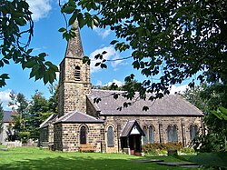
Castley is a village and civil parish in the county of North Yorkshire, England. It lies on a bend in the River Wharfe about 10 miles (16 km) north of the centre of Leeds. The population of the civil parish was estimated at 70 in 2015. The village appears in the Domesday Book as Castleai, a combination of castel, and lēah, meaning the clearing near the fort. Until 1974 it was part of the West Riding of Yorkshire. From 1974 to 2023 it was part of the Borough of Harrogate, it is now administered by the unitary North Yorkshire Council. The greater part of the Arthington Viaduct, which carries the Leeds to Harrogate railway line across the Wharfe valley, stands within the parish.
1. Listed buildings
Castley contains four listed buildings that are recorded in the National Heritage List for England. All the listed buildings are designated at Grade II, the lowest of the three grades, which is applied to "buildings of national importance and special interest". The parish contains the village of Castley and the surrounding countryside, and the listed buildings consist of a house, a boundary stone, a railway viaduct and a milepost.
1. See also


1. References


1. = Sources for listed buildings =


1. External links
Media related to Castley at Wikimedia Commons
Lieux à Proximité Voir Menu


Weeton (Yorkshire du Nord)
Pool-in-Wharfedale

