English
 Français

Kentmere Reservoir
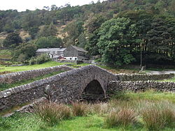
Kentmere Reservoir is a water storage facility situated in the Kentmere valley in the county of Cumbria, England. It is located 10.5 kilometres (6.5 mi) north-northeast of the town of Windermere. The reservoir is fed by the streams which form the headwaters of the River Kent which rise 1.5 kilometres (0.93 mi) to the north in Hall Cove on the southern slopes of a mountainous ridge called High Street, which is named after the nearby Roman road. It is also fed by Lingmell Gill, which drains the large corrie on the western side of Harter Fell beneath the Nan Bield Pass. After Kentmere Tarn was drained to provide agricultural land in the 1840s, water supply to the mills further downstream became erratic, and the mill owners met to plan a reservoir to regulate the flow. They employed the water engineer John Frederick Bateman to advise, and the Act of Parliament obtained in 1845 authorised five reservoirs. Despite Bateman's preference for the reservoir at Skeggles Water, the millers opted to build that at Kentmere Head, which was completed in 1848, but cost a lot more than estimated. Millers paid for the water based on the drop in river level at their mill, with small mills exempt from charges. Soon after its completion, cheap coal became available, as railways arrived in the area, and the number of mills using water power steadily declined. This process was exacerbated by the Water Resources Act 1963, under which the Lancashire River Authority levied prohibitive charges for using water to generate power. The use of water power effectively ceased in 1972, with James Cropper becoming the owner of the reservoir, as the paper mills at Burneside were the last user of water from the reservoir. By 1995 there were serious problems with the dam, and there was talk of breaching the dam, so that it would no longer be subject to the provisions of the Reservoir (Safety Provisions) Act 1930. However, there was public outcry, because the reservoir is in an area of natural beauty, and despite not needing the water, Croppers paid for engineering work to remedy the faults, resulting in a slightly lower maximum water level, and a wall being constructed along the top of the dam to prevent wave action causing the downstream face to erode and possibly fail.
Lieux à Proximité Voir Menu

Kentmere

Col de Kirkstone

Troutbeck (South Lakeland)