
 English
 Français

Greenhill, Falkirk
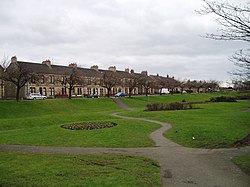
Greenhill is a village which lies in the Falkirk council area of Scotland. The village is located on the outskirts of Bonnybridge, 4.3 miles (6.9 km) west of Falkirk. Greenhill is situated south of the Forth and Clyde Canal and north of the railway line at Greenhill Junction. According to the 2001 census the village has 1,265 residents.
Nearby Places View Menu

292 m
Greenhill Lower railway station
Greenhill Lower railway station served the village of Greenhill, Falkirk, Scotland from 1848 to 1966 on the Scottish Central Railway.
531 m
Seabegs Wood
Seabegs Wood was the site of a Roman fortlet on the Antonine Wall in Scotland.
At Seabegs, the outline of Antonine's Wall, has lasted. Archaeologists from previous generations recorded this and stated that the ditch was deep and waterlogged.
There is an underpass under the Forth and Clyde Canal nearby known locally as the Pend.
In the 1890s, the Antonine Wall Committee of Glasgow Archaeological Society's cut several trenches across the Roman rampart. These uncovered its stone base. Subsequent excavations in 1977 found a Roman fortlet attached to the south of the Rampart. In 1981, a mound was examined but little has been discovered. Seabegs Wood was a portion of the ancient Barony of Seabegs. Seabegs Wood is part of a UNESCO World Heritage Site representing the best preserved portion of the ancient Roman Antonine Wall. The Seabegs Collection of Ancient Roman Coinage was donated to Dalhousie University, Halifax, Nova Scotia, Canada to commemorate this connection and consists of gold, silver and bronze portrait coinage depicting the majority of the ancient Roman emperors.
The forts to this fortlet are Castlecary in the west and Rough Castle in the east. Sir George Macdonald and others theorized that because these neighbouring forts were relatively widespread another structure was likely in the Seabegs area.
No coinage has been recovered nor any inscriptions. There are two marching camps nearby at Dalnair and Milnquarter.
Many Roman forts along the wall held garrisons of around 500 men. Larger forts like Castlecary and Birrens had a nominal cohort of 1000 men but probably sheltered women and children as well although the troops were not allowed to marry. There is likely too to have been large communities of civilians around the site.
637 m
Bonnybridge railway station
Bonnybridge railway station was a railway station serving the village of Bonnybridge in central Scotland. The station was located on a short branch off the Caledonian Railway line from Coatbridge to Larbert (There were two other "Bonnybridge" stations, on the Edinburgh and Glasgow main line and the Kilsyth line respectively).
817 m
Bonnybridge
Bonnybridge (Scottish Gaelic: Drochaid Bhunaich; Scots: Bonniebrig) is a village in the Falkirk council area of Scotland. It is 4.0 miles (6.4 km) west of Falkirk, 5.3 miles (8.5 km) north-east of Cumbernauld and 8.3 miles (13.4 km) south-southwest of Stirling. The village is situated near the Bonny Water which runs through the town and lies north of the Forth and Clyde Canal. To the south-east of Bonnybridge is a well-preserved section of the Antonine Wall, and the remnants of Rough Castle Fort, the most complete of the surviving Roman forts of the wall.
According to the 2001 Census, the population stands at 6,870 residents. However, the Bonnybridge settlement area, which includes Banknock, Denny, Dunipace and Haggs has a total population of around 24,370.