


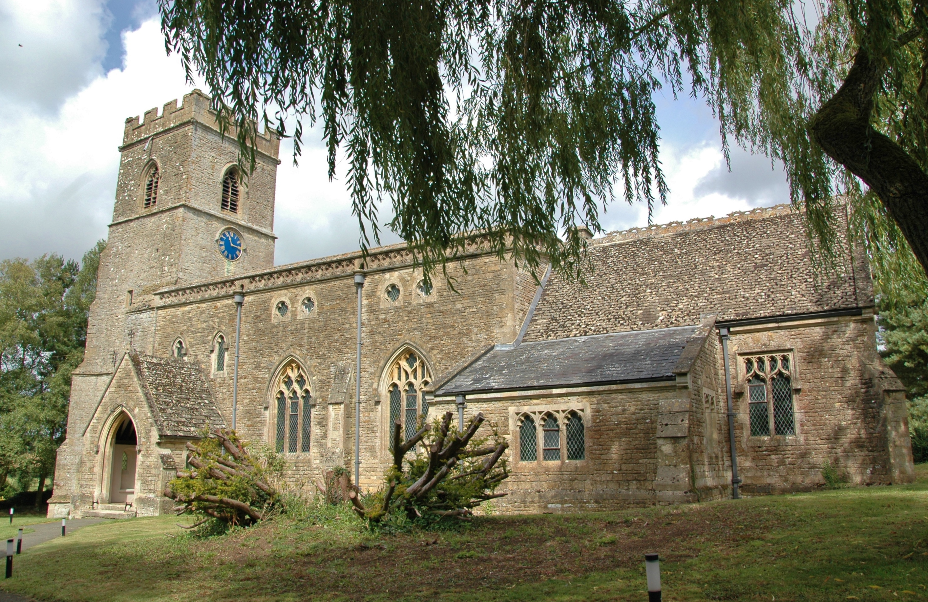
Upper Heyford est une paroisse civile et un village de l'Oxfordshire, en Angleterre.
Location

0 m
Upper Heyford is a village and civil parish about 6 miles northwest of Bicester in Oxfordshire, England. The 2011 Census recorded the parish's population as 1,295.
The village is just east of the River Cherwell. "Upper" distinguishes it from Lower Heyford which is about 1 mile "lower", downstream along the Cherwell valley. The parish measures about 2+1⁄2 miles east–west and almost 2 miles north–south. In 1959 it covered 1,628 acres.
The parish's western boundary is just west of the river. Chilgrove Drive, a continuation of Aves ditch, forms part of the parish's eastern boundary. Field boundaries bound the parish on the south. In the north the boundary crosses the former RAF Upper Heyford airfield, following the course of former field boundaries.
697 m
Heyford Park School is a free school in Upper Heyford, England. The school was opened in November 2020 after the Heyford Park Free School was closed in September 2020. In the school's most recent inspection Ofsted rated it as good. The school is a part of the Eynsham Partnership Academy Trust.
1.6 km
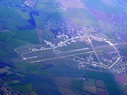
Royal Air Force Upper Heyford or more simply RAF Upper Heyford is a former Royal Air Force station located 5 miles north-west of Bicester near the village of Upper Heyford, Oxfordshire, England. In the Second World War the airfield was used by RAF Bomber Command. During the Cold War, Upper Heyford was one of the former RAF bases chosen to house the United States Air Force Strategic Air Command nuclear-capable bombers on 90-day TDY deployments until 1959, SAC Operation Reflex deployments from 1959 until 1965, from 1966 United States Air Forces in Europe tactical reconnaissance aircraft, and from 1970 General Dynamics F-111 Aardvark strike aircraft.

1.7 km
Heyford Park is a civil parish in the Cherwell district of Oxfordshire, England. It was created in 2019 from portions of the parishes of Ardley, Somerton and Upper Heyford. The proposal to create the new parish was made by Upper Heyford Parish Council in January 2017. The parish council initially had seven seats, and nominations for candidates to fill these were opened in March 2019, the election to be held on 2 May 2019. The parish includes most of the former RAF Upper Heyford airfield and Heyford Park School. It is bordered by the civil parishes of Somerton, Ardley, Middleton Stoney, Lower Heyford and Upper Heyford, all being in the Cherwell district.
Until the 2024 United Kingdom general election, the parish lay entirely within the Banbury constituency. Following that election, the parish has been represented by two Members of Parliament: the portion ceded from Somerton remains within the Banbury constituency, but the bulk of the parish now lies within the new Bicester and Woodstock constituency.
The Heyford Park name can also be attributed to the housing development by Dorchester Living which was acquired by the property development group in 2014. Dorchester Living state "We acquired the site in 2009 and gained initial consent for 1,075 homes". The development companies' 'Master Plan' comprises a village green, extensive leisure and retail facilities, and a new free school, all of which have now been built, bringing the current development area to over 700 homes within a 1231 acre plot in the Oxfordshire countryside.

1.8 km
Lower Heyford is a village and civil parish beside the River Cherwell in Oxfordshire, about 6 miles west of Bicester. The 2011 Census recorded the parish's population as 492.
The parish measures about 1+1⁄2 miles east–west and about 2 miles north–south. It is bounded by the River Cherwell to the west, Aves ditch to the east, and field boundaries to the north and south. In 1959 the parish covered an area of 1,765 acres.
Notes et références
(en) Cet article est partiellement ou en totalité issu de l’article de Wikipédia en anglais intitulé « Upper Heyford, Oxfordshire » (voir la liste des auteurs).