
 English
 Français
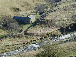
Hope Woodlands
Hope Woodlands est une paroisse civile du Derbyshire, en Angleterre.
Nearby Places View Menu

3.9 km
The Church of the Holy and Undivided Trinity, Edale
The Church of the Holy and Undivided Trinity, Edale, is a Grade II listed parish church in the Church of England in Edale, Derbyshire.

3.9 km
Grindslow Knoll
Grindslow Knoll is a hill in the Dark Peak area of the Peak District National Park in Derbyshire, England. It is joined to Kinder Scout by a high col though from most angles appears as an independent peak. It is the high point at the western side of Grindsbrook Clough.

4.1 km
Lose Hill
Lose Hill lies in the Derbyshire Peak District. It is the south-east corner of the parish of Edale and the end of the Great Ridge that runs from Rushup Edge to the west (over Mam Tor, Hollins Cross and Back Tor).
Local access activist G. H. B. Ward was given an area of Lose Hill by the Sheffield and District Federation of the Ramblers Association in 1945, which was named Ward's Piece; he subsequently presented this to the National Trust.
Suggested explanations for the name of Lose Hill include that it derives from the Old English hlose, meaning pigsties, or that it may be a corruption of ‘loose’, as in ‘free land’. Another author (Murray) argues that Lose Hill should actually be called Laws Hill.
The hill's counterpart, Win Hill, lies to the east on the opposite side of the River Noe. In relatively recent times, the two hills' names have prompted a fanciful tale concerning the outcome of an imagined 7th-century battle between the forces of Edwin of Northumbria and Cynegils of Wessex. Edwin's forces occupied Win Hill, while Cynegils' men camped on Lose Hill. As the battle progressed, Cynegils' forces advanced up Win Hill, and Edwin's retreated behind a temporary wall they had built near the summit. They pushed the boulders of the wall downhill, crushing the Wessex soldiers and gaining victory in the battle. However, there is no historical basis for the tale, and no evidence of any battle ever being fought here.
4.1 km
Lower Hollins
Lower Hollins is a Site of Special Scientific Interest (SSSI) within Peak District National Park in Derbyshire, England. It is located 950m east of the village of Edale, within the Vale of Edale in the valley of the River Noe. Lower Hollins SSSI is protected because of the species rich grasslands that are managed as hay meadows.

4.2 km
Edale
Edale is a village and civil parish in the Peak District, Derbyshire, England, whose population was 353 at the 2011 Census. Edale, with an
area of 7,030 acres (2,840 ha),
is in the Borough of High Peak.
Edale is best known to walkers as the start, or southern end, of the Pennine Way and, to less ambitious walkers, as a starting point for evening or day walks. The village is accessible by generally hourly railway services from Sheffield and Manchester. There are two pubs serving real ale and food.