
 English
 Français
Crook (Durham)
Crook est une ville d'Angleterre, située dans le comté de Durham. Ses houillères ont fait sa prospérité au XIXe siècle.
Nearby Places View Menu

0 m
Crook, County Durham
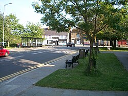
Crook is a market town in the Durham County Council unitary authority and ceremonial county of County Durham, England. It is located on the edge of Weardale and sometimes referred to as the "Gateway to Weardale".
Crook lies about 9 miles (14 km) south-west of Durham, 5 miles (8.0 km) north-west of Bishop Auckland and 2 miles (3.2 km) from Willington. The A689 road from Durham leads up through Wolsingham and Stanhope into the upper reaches of Weardale. Until 1974, the town was in Crook and Willington Urban District and had a parish council.

224 m
Crook Town A.F.C.
Crook Town Association Football Club is a football club based in Crook, County Durham, England. They are currently members of the Northern League Division One and play at the Sir Tom Cowie Millfield. The club won the FA Amateur Cup five times.

402 m
Crook railway station
Crook railway station served the town of Crook, County Durham, England. It was located on the Bishop Auckland and Weardale Railway line from Bishop Auckland to Blackhill between Wear Valley Junction and Tow Law.

1.9 km
Helmington Row
Helmington Row is a small village in County Durham, England. It is situated between Crook and Willington, about 7 miles south-west of Durham and 3 miles north-north-west of Bishop Auckland.
It has its own park known locally as the Rec, and a petrol station. The village is on the main bus route from Crook to Durham. Crook Golf Club lies to the North of the village. The village itself consists of several terraced streets with the almost totally abandoned Bowden Close within its boundaries.
There are around 6 main streets in the main block of houses (3 of those are very popular, Church Street, East View and Russ Street), other streets are situated along the road (not counted). In the 2001 census Helmington Row had a population of 228. There are two sets of allotments where local people may grow their own fruit and vegetables and keep small amounts of livestock.
The village once boasted several pubs, The Bowden Inn, the Shoulder of Mutton, The Helmington Inn and the Colliery Inn. The latter has recently been renamed the Copper Mine.
It is also home to the 'field of dreams' which refers to a small football pitch used by locals of all ages. In the summer it is often occupied everyday and is the main attraction of the town.

2.0 km
Howden-le-Wear
Howden-le-Wear is a village in County Durham, in England. Howden-le-Wear is approximately 1 mile south of the large market town of Crook. It has a number of shops including the village One Stop convenience store, hairdressers, butchers and the petrol station.
The 2011 Census reported that Howden has a population of 1,535.