
 English
 Français

South Pennines
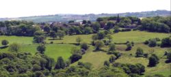
The South Pennines is a region of moorland and hill country in northern England lying towards the southern end of the Pennines. In the west it includes the Rossendale Valley and the West Pennine Moors. It is bounded by the Greater Manchester conurbation in the west and the Bowland Fells and Yorkshire Dales to the north. To the east it is fringed by the towns of West Yorkshire whilst to the south it is bounded by the Peak District. The rural South Pennine Moors constitutes both a Site of Special Scientific Interest and Special Area of Conservation.
Nearby Places View Menu
937 m
King James's School, Almondbury
King James's School is a coeducational secondary school located in Almondbury in the English county of West Yorkshire.

966 m
Woodsome Hall
Woodsome Hall is a 16th-century country house in the parish of Almondbury, near Huddersfield, West Yorkshire, England. It is now the clubhouse of Woodsome Hall Golf Club and a Grade I listed building.
Built in the Elizabethan era as a hall house, Woodsome evolved in stages in the possession of several generations of the local Kaye family. The main hall range is built in two storeys with gabled forward projecting wings and a two storey gabled porch. At the rear of each end are L-shaped extensions forming a courtyard with a fountain.
1.3 km
Farnley Tyas
Farnley Tyas is a village in the parish of Kirkburton, in the Kirklees district, in the county of West Yorkshire, England 3 miles (4.8 km) south east of Huddersfield. It is located on a hilltop between Almondbury, Castle Hill, Thurstonland and Honley. It is mostly rural and farmland with private housing and some local authority social housing. In 1921 the parish had a population of 486.
The village has a public house, the Golden Cock Inn, a First School catering for around 50 children aged from four to ten years old, a bowling club and a small sports field. St Lucius' Church, along with All Hallows' and St Michael and St Helen's Churches in Almondbury form the Parish of Almondbury with Farnley Tyas.

1.6 km
Almondbury
Almondbury (English: ) is a village 2 miles (3.2 km) south-east of Huddersfield town centre in the Kirklees district, of West Yorkshire, England. The population of Almondbury in 2001 was 7,368 increasing to 18,346 at the 2011 census.
The village is close to Castle Hill, Huddersfield's most prominent landmark. Almondbury has several notable buildings, including the 16th-century Wormald's Hall, now the village Conservative club, and the Grade I listed All Hallows Church. The church is mainly Perpendicular in style but the chancel is earlier. The roofs have a long inscription dated 1522 on the cornice. Other wooden furniture of interest includes a Georgian lectern, a pew of 1605 and a late Perpendicular font cover.