


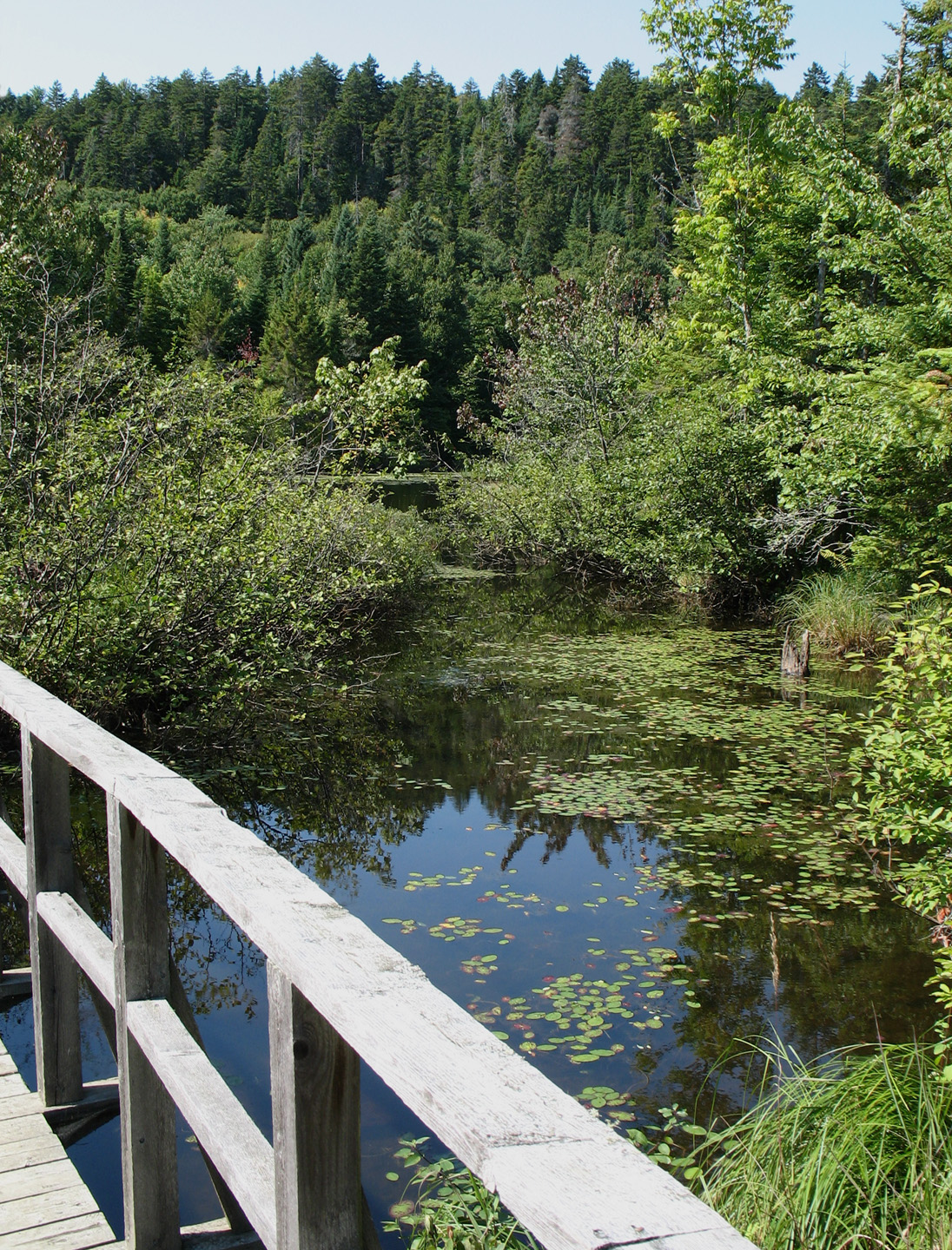
La réserve naturelle des Marais-du-Nord, communément nommée Marais-du-Nord, est une réserve naturelle en milieu humide. D’une superficie de 64 ha, elle est située sur une propriété privée sur la rive ouest du Lac Saint-Charles à une vingtaine de kilomètres au nord de Québec. Accessible au public, la réserve est un lieu prisé entre autres par les observateurs et les photographes d'oiseaux.
Gallery


Sponsored
Location
700 m
The rivière Noire is a tributary of the rivière des Hurons, flowing in the heart of the municipality of the townships of Stoneham-et-Tewkesbury, located north of the city of Quebec, in the La Jacques-Cartier Regional County Municipality, in the administrative region of the Capitale-Nationale, in the province of Quebec, in Canada.
The Black River valley is mainly served by route 175 and boulevard Talbot.
The surface of the Black River is generally frozen from the beginning of December to the end of March; however, safe circulation on the ice is generally done from the end of December to the beginning of March. The water level of the river varies with the seasons and the precipitation; the spring flood occurs in March or April.

935 m
Lac-Delage is a town in the Capitale-Nationale region of Quebec, Canada, located on the eponymous Lake Delage.
2.1 km
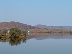
Lake Saint-Charles is a lake located in the Capitale-Nationale region of Quebec, Canada. It is located partially within the Quebec City borough of La Haute-Saint-Charles and partially within the united township municipality of Stoneham-et-Tewkesbury.
Lake Saint-Charles is the source of the Saint-Charles River. Located less than 20 minutes from downtown Quebec City, it is an important natural habitat to Quebec City area residents. Lac-Delage and the borough of Charlesbourg also administer a portion of its drainage basin.
Lac Saint-Charles is served on the east side mainly by the Grande Ligne road and on the west side by the Lac-Saint-Charles road for the needs of recreational tourism and forestry.
The surface of Lake Saint-Charles is generally frozen from the beginning of December to the end of March; safe circulation on the ice is generally done from the end of December to the beginning of March.
2.9 km
The rivière Hibou is a tributary of the rivière des Hurons, flowing in the heart of the municipality of the townships of Stoneham-et-Tewkesbury, in the La Jacques-Cartier Regional County Municipality, in the administrative region of Capitale-Nationale, in the province of Quebec, in Canada.
Located north of Quebec, the Hibou river valley is mainly served by the Grande-Ligne path, the Hibou path and a few urban streets.
The surface of the Hibou River is generally frozen from the beginning of December to the end of March; however, safe circulation on the ice is generally done from the end of December to the beginning of March. The water level of the river varies with the seasons and the precipitation; the spring flood occurs in March or April.
5.4 km
La Petite Rivière is a tributary stream of the Nelson River, flowing in the administrative region of Capitale-Nationale, in the province from Quebec, to Canada. The course of the river crosses:
Quebec City over only a hundred metres;
the municipality of Lac-Saint-Charles over only a hundred metres;
the municipality of Saint-Gabriel-de-Valcartier in the La Jacques-Cartier Regional County Municipality.
This watercourse is part of the watershed of the Saint-Charles River.
The valley of "La Petite Rivière" is mainly served by boulevard Valcartier and rue Morley.
The surface of "La Petite Rivière" is generally frozen from the beginning of December to the end of March; however, safe circulation on the ice is generally done from the end of December to the beginning of March. The water level of the river varies with the seasons and the precipitation; the spring flood occurs in March or April.
Book your tour near
Réserve naturelle des Marais-du-Nord
Book Now
4.2
in partnership with
GetYourGuide.com