


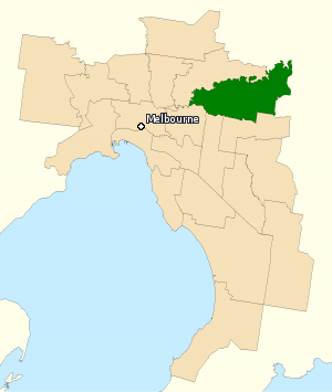
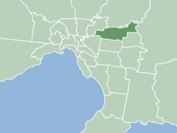
La circonscription de Menzies est une circonscription électorale australienne située dans la banlieue est de Melbourne, au Victoria. La circonscription a été créée en 1984 et porte le nom de Robert Menzies, qui est le premier ministre d'Australie à avoir occupé le plus longtemps le poste. Située dans la banlieue Est de Melbourne, elle comprend les quartiers de Bulleen, Doncaster, Donvale, Templestowe et Warrandyte.
Location
1 explorer visited this place
0 m
The Division of Menzies is an Australian Electoral Division in the state of Victoria. The division is located in the north-eastern suburbs of Melbourne and covers parts of City of Manningham and to a smaller extent, City of Whitehorse.

655 m
Currawong Bush Park is a nature park located in the outer eastern Melbourne suburbs of Doncaster East, Warrandyte and Donvale, along Mullum Creek. It covers 59 hectares of remnant bushland and contains archaeological sites significant to the traditional owners of the area, the Wurundjeri people of the Kulin nation.
890 m
The City of Manningham is a local government area in Victoria, Australia in the north-eastern suburbs of Melbourne and is divided into 12 suburbs, with the largest being Doncaster and Doncaster East. It comprises an area of 113 square kilometres and had a population of 125,508 in June 2018.
The district spans a roughly east–west direction along the southern banks of the Yarra River and across the undulating valleys of the Koonung, Ruffey and Mullum Mullum Creeks, alternating from typical low density suburban housing in the west to remnant bushland, within a green wedge, in the east. As such, the district encompasses the transition between the built and natural environments in Melbourne's east and promotes itself as a "balance of city and country".
Formerly the City of Doncaster & Templestowe, the district is situated in the Wurundjeri nation's territory. Most of the first European settlers to the area were orchardists, arriving through the 1850s. Gold was first discovered in Victoria around the same time at Andersons Creek, in Warrandyte, however, the district saw varied growth as periods of low density suburban development occurred sporadically throughout the mid-late 20th century.
903 m
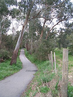
The Mullum Mullum Creek Linear Park is located east of Melbourne, Australia in the suburbs of Doncaster East and Donvale. It stretches for roughly 9 km along the western banks of the Mullum Mullum Creek between Heidelberg-Warrandyte Road and The Eastlink Trail. Facilities include sealed pathways, barbecues and shelters. Other features include, bush walking tracks, trails and equestrian trails. Throughout much of the 1990s, extensive regenerative planting was conducted throughout the entire length of the park; this has restored much of the native riparian bushland within the park, most prominently the Mullum Mullum Wetlands.
1.0 km
Warrandyte South is a locality within Greater Melbourne, beyond the Melbourne Metropolitan Area Urban Growth Boundary, 25 km north-east of Melbourne's Central Business District, located within the City of Manningham local government area. Warrandyte South recorded a population of 671 at the 2021 census.
It is bounded in the west by Ringwood Road, in the north by Anzac Road, in the east by Jumping Creek and in the south by Old Warrandyte Road.
Book your tour near
Circonscription de Menzies
Book Now
4.1
in partnership with
GetYourGuide.com
Elle est un siège sûr pour le Parti libéral australien.