


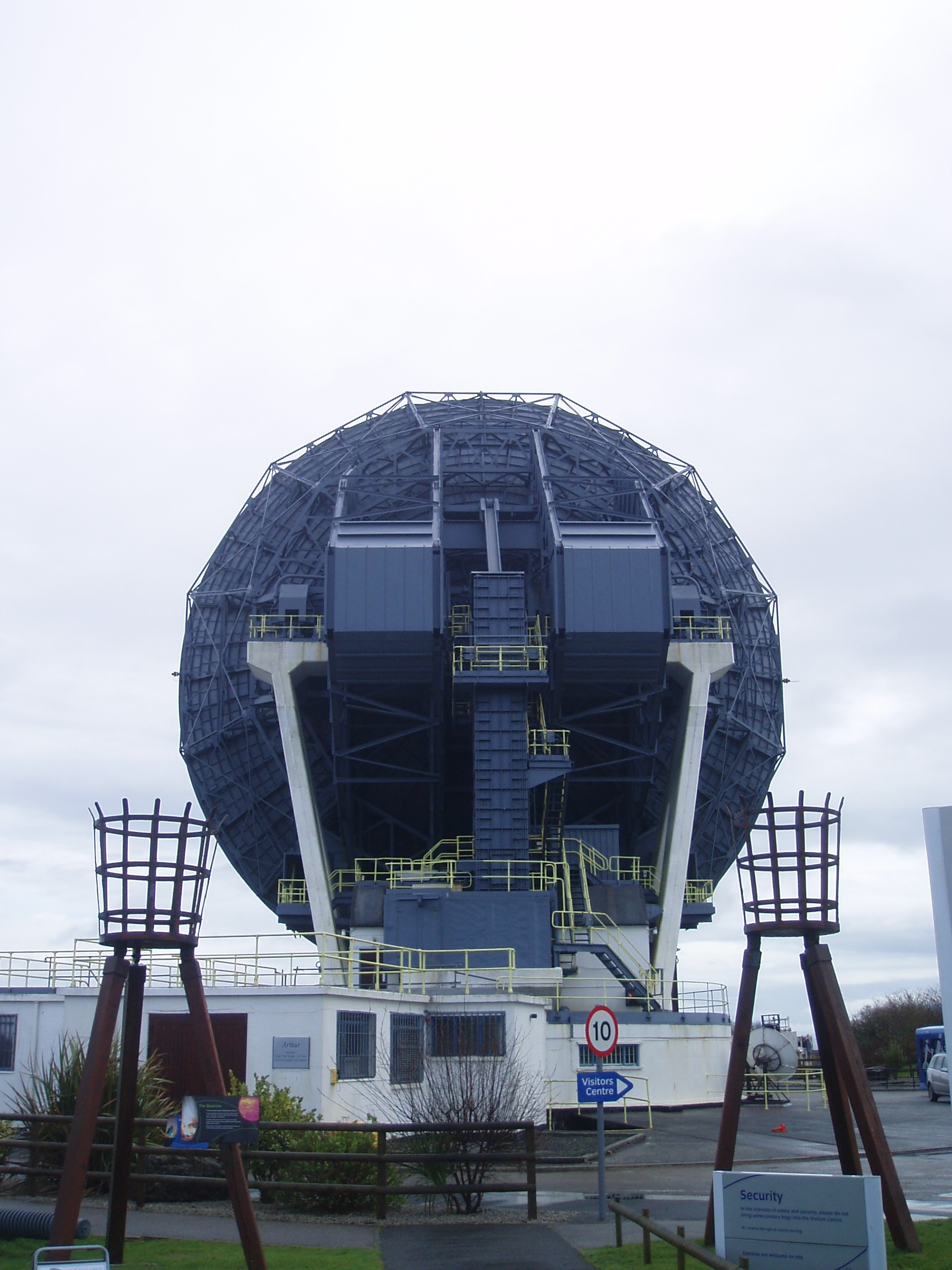
Goonhilly Satellite Earth Station is a large radiocommunication site located on Goonhilly Downs near Helston on the Lizard peninsula in Cornwall, Britain. Owned by Goonhilly Earth Station Ltd under a 999-year lease from BT Group plc, it was at one time the largest satellite earth station in the world, with more than 30 communication antennas and dishes in use.
Gallery


Sponsored
Location

1.2 km
Goonhilly Downs is a Site of Special Scientific Interest that forms a raised plateau in the central western area of the Lizard peninsula in southern Cornwall, England. It is one of 229 English national nature reserves designated by Natural England with an area of almost 1,270 hectares.

1.6 km
The Lizard is a peninsula in southern Cornwall, England, United Kingdom. The southernmost point of the British mainland is near Lizard Point at SW 701115; The Lizard, also known as Lizard village, is the most southerly region on the British mainland, and is in the civil parish of Landewednack. The valleys of the Helford River, and the lake known as Loe Pool form the northern boundary, with the rest of the peninsula surrounded by sea. The area measures about 14 by 14 miles. The Lizard is one of England's natural regions and has been designated as a National Character Area 157 by Natural England. The peninsula is known for its geology and for its rare plants and lies within the Cornwall National Landscape, an Area of Outstanding Natural Beauty, also known as a National Landscape.
The Lizard's coast is particularly hazardous to shipping and the seaways round the peninsula were historically known as the "Graveyard of Ships". The Lizard Lighthouse was constructed at Lizard Point in 1752, and the RNLI operates the Lizard lifeboat station.
1.7 km
RAF Dry Tree was a Royal Air Force early warning radar station for detecting enemy aircraft during the Second World War. It was built in 1940 on Goonhilly Downs, on the Lizard peninsula in Cornwall, a short distance to the south-east of the Goonhilly Earth Station. It was named from the standing stone on the land known as the Dry Tree menhir.

2.3 km
Traboe is a hamlet on the Lizard Peninsula, Cornwall, England, United Kingdom. Traboe is about 5 km west of St Keverne; nearby is Traboe Cross, a junction on the B3293 road. It is approximately a mile down the road from Goonhilly Satellite Earth Station. It contains eleven houses and a building which used to house Rosuick Farm Shop, this being the purpose for which it was built. The list of houses includes a converted inn and a converted school house.
There is a well situated at the back of the green. A tree was planted on the green by residents of the hamlet to commemorate the millennium.
Traboe lies within the Cornwall Area of Outstanding Natural Beauty.
The name Traboe is a contraction of the Cornish language Treworabo, which contains the elements tre, meaning 'farm' or 'settlement', and Gworabo, a personal name.

2.6 km
Newtown-in-St Martin is a hamlet in the parish of St Martin-in-Meneage, Cornwall, England. Newtown is south-southeast of St Martin's Green.
The site also links into undersea cable lines.