
 English
 Français

Bolton Parish Church, East Lothian
Bolton Parish Church is a church in Bolton, East Lothian, Scotland. It is part of the Church of Scotland and (along with Yester Church Saltoun Parish Church) serves the parish of Yester, Bolton and Saltoun.
Nearby Places View Menu

64 m
Bolton, East Lothian
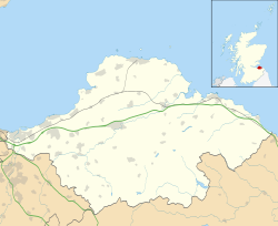
Bolton is a hamlet and the third smallest parish in East Lothian, Scotland. It lies approximately 2 miles (3.2 km) south of Haddington and 20 miles (32 km) east of Edinburgh, and is an entirely agricultural parish, 6 miles (9.7 km) long by about 1.25 miles (2.01 km) wide. The most notable buildings in the hamlet are the Parish Church, an 18th-century dovecote or "doo'cot" and the former Bolton Primary School, which now serves as the village hall.

2.1 km
Lennoxlove House
Lennoxlove House is a historic house set in woodlands half a mile south of Haddington in East Lothian, Scotland. The house comprises a 15th-century tower, originally known as Lethington Castle, and has been extended several times, principally in the 17th, 19th and 20th centuries. The house is protected as a category A listed building, and is described by Historic Scotland as "one of Scotland's most ancient and notable houses." The wooded estate is included on the Inventory of Gardens and Designed Landscapes in Scotland, the national listing of significant gardens.
It is now the seat of the Duke of Hamilton and Brandon.

2.5 km
Samuelston
Samuelston (Scots: Sammelstoun) is a small town just outside of Haddington, East Lothian. It has a population of 957.
George Ker, laird of Samuelston, supervised building work at the church of Ladykirk for James IV. His daughter Nichola Ker married Alexander Home, 2nd Lord Home.
2.5 km
East Lothian
East Lothian (; Scots: Aest Lowden; Scottish Gaelic: Lodainn an Ear) is one of the 32 council areas of Scotland, as well as a historic county, registration county and lieutenancy area. The county was called Haddingtonshire until 1921.
In 1975, the historic county was incorporated for local government purposes into Lothian Region as East Lothian District, with some slight alterations of its boundaries. The Local Government etc. (Scotland) Act 1994 later created East Lothian as one of 32 modern council areas. East Lothian lies south of the Firth of Forth in the eastern central Lowlands of Scotland. It borders Edinburgh to the west, Midlothian to the south-west and the Scottish Borders to the south. Its administrative centre and former county town is Haddington while the largest town is Musselburgh.
Haddingtonshire has ancient origins and is named in a charter of 1139 as Hadintunschira and in another of 1141 as Hadintunshire. Three of the county's towns were designated as royal burghs: Haddington, Dunbar, and North Berwick.
As with the rest of Lothian, it formed part of the Anglo-Saxon kingdom of Bernicia and later the Kingdom of Northumbria. Popular legend suggests that it was at a battle between the Picts and Angles in the East Lothian village of Athelstaneford in 823 that the flag of Scotland was conceived. From the 10th century, Lothian transferred from the Kingdom of England to the authority of the monarchs of Scotland. It was a cross-point in battles between England and Scotland and later the site of a significant Jacobite victory against Government forces in the Battle of Prestonpans. In the 19th century, the county is mentioned in the Gazetteer for Scotland as chiefly agricultural, with farming, fishing and coal-mining forming significant parts of the local economy.