


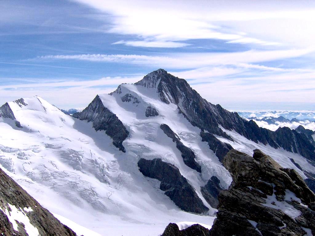
L'aiguille du Tacul est un sommet du massif du Mont-Blanc, en Haute-Savoie, culminant à 3 444 mètres. Bien visible depuis le Montenvers, elle a porté jusqu'à la fin du XIXe siècle le nom de Périades, aujourd'hui donné au seul petit groupe de pointes rocheuses situé de l'autre côté du col du Tacul.
Book your tour near
Aiguille du Tacul
Book Now
4.3
in partnership with
GetYourGuide.com
Gallery

Sponsored
Location
2 explorers visited this place

1.0 km
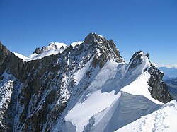
Les Périades) is a sharp and heavily pinnacled mountain ridge, stretching for over 1,500 metres in the Mont Blanc massif in Haute-Savoie, France. It runs in a southerly direction from the Col du Tacul to the Col du Mont Mallet. Its highest point is Pointe Cupelin)
Principal points along the crest of Les Périades, from south to north:
Pointe Auguste Cupelin - 3549 m
Pointe 3517 m
Pointe de la Fenêtre - 3507 m
Pointe de Sisyphe - 3460 m
Pointe Alfred Simond 3457 m
Pointe Nini - 3455 m
Pointe Francois Simond - 3493 m
Pointe des Périades - 3503 m
Les Périades are divided into three parts by the Brèche Puiseux and by the Brèche des Périades.
A bivouac hut was installed near Pointe de Sisyphe in 1928 at a height of 3,455 metres. It eventually became the property of the French Alpine Club, and was renovated in 1996. The site collapsed in 2019 during the summer heatwave, which caused the previously frozen ground to become unstable. It was replaced in 2020, following a public fund-raising campaign, and can accommodate three or four people.

1.9 km
The Leschaux Hut is a refuge in the Mont Blanc massif in the Alps. It is located at 2,431 m on the north side of the Glacier de Leschaux – a tributary of the Mer de Glace. It is owned by the CAF and can accommodate up to 19 people. The hut is used as a base by mountaineers climbing peaks such as Grandes Jorasses, Petites Jorasses and Mont Mallet. It is accessed by going up the Mer de Glace from Montenvers, and then up the Glacier de Leschaux. The first refuge was built in 1929. It was enlarged to 30 seats in 1934, but destroyed by an avalanche in 1954. A new hut was built in 1968 and was enlarged in 2003.

2.2 km
Mont Mallet) is a mountain in the Mont Blanc massif in Haute-Savoie, France. It lies on a spur running northwards from the French-Italian frontier ridge, and can be most easily reached from the Aiguille de Rochefort.
Mont Mallet was first climbed on 4 September 1871. The first ascension party consisted of Leslie Stephen, Gabriel Loppé, F. Wallroth, Melchior Anderegg, Cachet and A. Tournier. They reached it via its southern ridge, a route now graded on the French adjectival climbing scale as PD. Its north ridge was first climbed in 1882.
2.3 km
The Dôme de Rochefort is a mountain in the Mont Blanc massif in Haute-Savoie, France and of Aosta Valley, Italy.
2.5 km
The Aiguille de Rochefort is a mountain in the Mont Blanc massif in France and Italy. The peak lies on the Rochefort arête between the Dent du Géant and the Grandes Jorasses and is usually climbed during a traverse of the ridge.
The first ascent of the peak was by James Eccles and guides Alphonse and Michel Payot on 14 August 1873.
Notes et références
Portail de la montagne Portail des Alpes Portail de Chamonix-Mont-Blanc
Book your tour near
Aiguille du Tacul
Book Now
4.3
in partnership with
GetYourGuide.com