


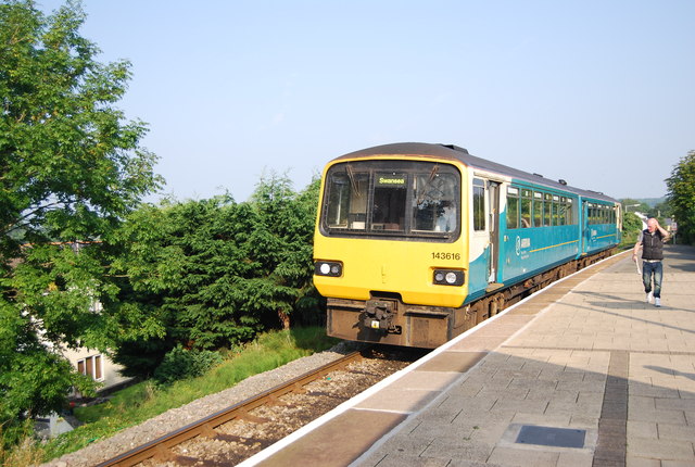
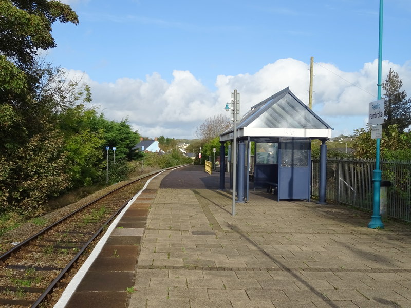
Pembroke railway station serves the town of Pembroke, Pembrokeshire, Wales.
Gallery

Sponsored
Location
1 explorer visited this place

177 m
The Cantref of Penfro was one of the seven cantrefi of the Kingdom of Dyfed. It subsequently became part of Deheubarth in around 950. It consisted of the long peninsular part of Dyfed south of the Eastern Cleddau and the Daugleddau estuary, and bordered on its landward side by Cantref Gwarthaf. The name, meaning "land's end", derives from Pen and "fro". Its area was approximately 140 square miles.
It was divided into two commotes: Cwmwd Penfro in the southwest and Cwmwd Coedrath in the northeast, as shown in the map. The eastern part of Cwmwd Penfro was sometimes called Cwmwd Maenorbier, and the northern part of Cwmwd Coedrath was sometimes called Cwmwd Arberth, but both these were post-Norman lordships, and were probably not genuine commotes. Its civil headquarters were at Pembroke: Rhoscrowther or Penally might have been its ecclesiastical centre.
The cantref was made part of the Norman March in the 12th century, and many castles were built, including those of Carew, Manorbier, Narberth, Pembroke, and Tenby. The area became English-speaking, as it continues today, except in the northern part of Narberth parish.
At the time of the 1535 Acts of Union, the cantref was split between two newly formed hundreds, when Cwmwd Penfro became Castlemartin Hundred, and Cwmwd Coedrath was merged into Narberth Hundred.

326 m
Pembroke's town walls are a Grade II*-listed medieval defensive structure around the town of Pembroke, Pembrokeshire, Wales. They were probably built beginning in the late 13th century by the Earls of Pembroke, although it is uncertain when they were finished. Most of the walls have not survived, but there are visible sections and two bastions exist, one with a restored late 18th-century gazebo atop it.
356 m
Pembroke Rural District was a rural district in the administrative county of Pembrokeshire, Wales from 1894 to 1974, covering an area in the south of the county. It surrounded, but did not include, the town of Pembroke after which it was named.

645 m
Pembroke St Michael is an electoral ward in the town of Pembroke, Pembrokeshire, Wales. It covers the east area of the town.
The ward currently elects a county councillor to Pembrokeshire County Council and three town councillors to Pembroke Town Council. Prior to local government reorganisation in 1995, the ward elected two councillors to South Pembrokeshire District Council and an electoral division with the same name covering a slightly larger area elected one county councillor to Dyfed County Council.
According to the 2011 UK Census the population of the ward was 2,408.
A boundary review took place in 2019, where it was noted that the number of eligible voters was 32% above the average for an electoral ward in Pembrokeshire. As a result, it was recommended that part of the ward was transferred to the neighbouring St Mary South ward, reducing the number of electors by 531. These changes came into effect in 2021.

756 m
Pembroke is a town and community in Pembrokeshire, Wales, with a population of 7,552. The names of both the town and the county have a common origin; both are derived from the Cantref of Penfro: Pen, 'head' or 'end', and bro, 'region', 'country', 'land', which has been interpreted to mean either 'Land's End' or 'headland'.
Pembroke features a number of historic buildings, town walls, complexes and Pembroke Castle which was the birthplace of Henry Tudor, who became Henry VII of England.