


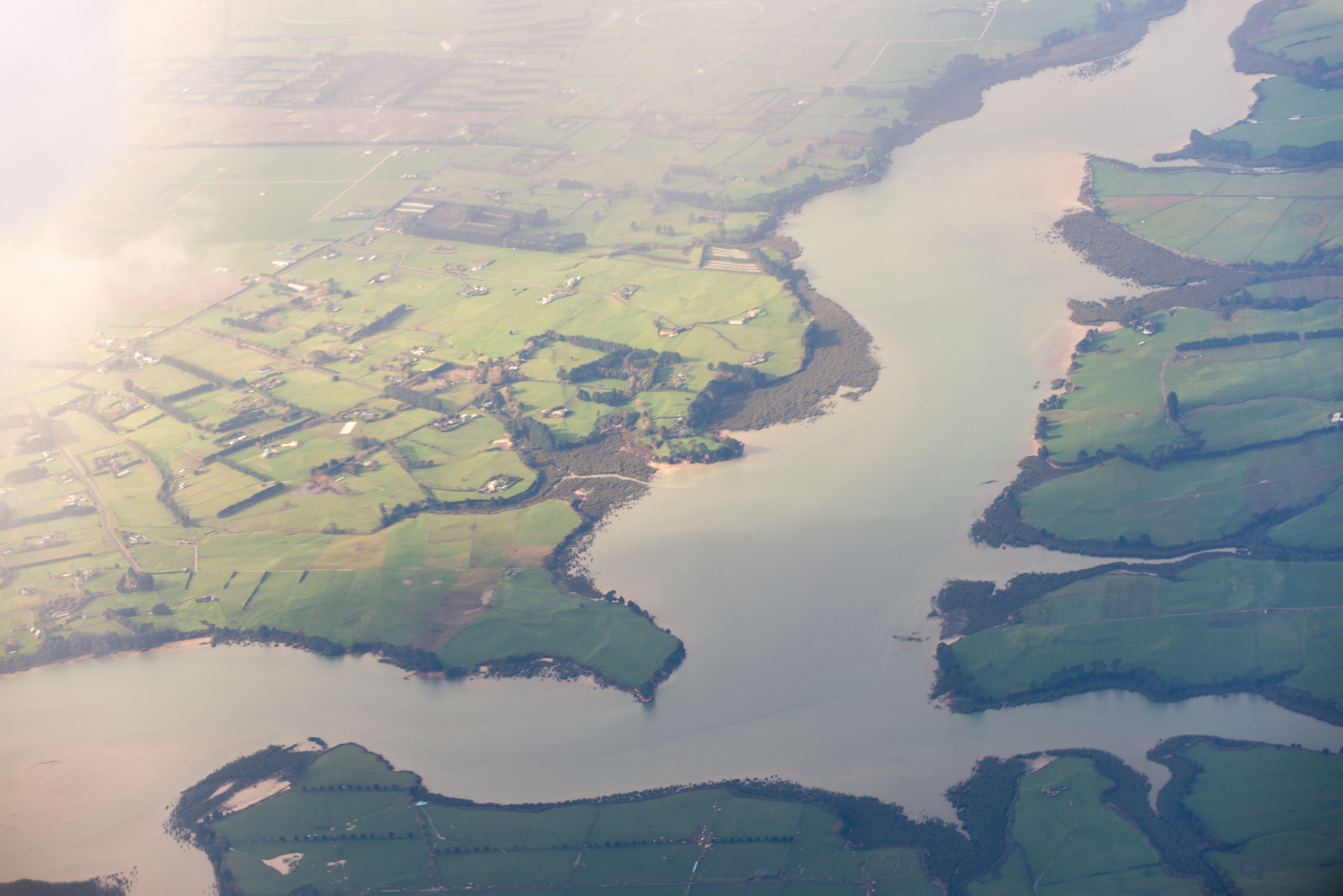
The Taihiki River is a river of the Auckland Region of New Zealand's North Island. It flows generally northeast from its sources north of Patumahoe to reach the Waiuku River shortly before the latter's outflow into the Manukau Harbour. As with the Waiuku River, much of the Taihiki's length is as a wide silty estuary.
Book your tour near
Taihiki River
Book Now
4.1
in partnership with
GetYourGuide.com
Gallery

Sponsored
Location
1.2 km
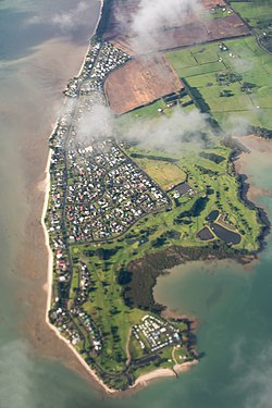
Glenbrook Beach is a rural community at the northern end of a peninsula formed between the Waiuku River and Taihiki River in Auckland, New Zealand. Waiuku is 14 km south by road.
The area is also known as Kawahai, after a species of fish which has been a substantial food source for the local Ngāti Te Ata iwi.
Glenbrook Beach was first subdivided in the mid 1920s. Electric power supply was connected at the end of the decade.
2.1 km
Clarks Beach is a small town of Auckland, New Zealand. It is in the former Franklin District local government area.
Primarily a beachside rural town, situated within the Manukau Harbour, at the mouth of the Waiuku River, it fronts the harbour and is north facing. It is known as one of the few beaches where scallops can be collected by hand at low tide.
About 50 ha immediately to the east of the existing town was rezoned to allow mixed housing in 2016. The Clarks Beach Waterfront Estate development started subsequently in 2019.
Seagrove aerodrome operated near Clarks Beach during World War II.

2.6 km
The Waiuku River, also known as the Waiuku Estuary, is an estuarial arm of the Manukau Harbour, near the town of Waiuku, south-west of Auckland. It joins the harbour at the south west and extends south for 12 kilometres, having its head close to the town of Waiuku.

4.6 km
Waiau Pa is a small settlement south of Auckland, New Zealand. It is in the Franklin Ward of Auckland Council. The name means "river of swirling currents" in the Māori language.

6.3 km
Matakawau Point is a rural settlement on the east side of the Āwhitu Peninsula and west side of the Manukau Harbour in the Auckland Region of New Zealand. The mouth of Matakawau Creek is south of Matakawau Point.
The sandstone cliffs of the coast are prone to erosion, which has resulted in some areas of the Matakawau Point Reserve been fenced off. The local beaches are Sargeants Beach and Matakawau Beach. The latter beach and other low-lying areas are at risk of flooding.