


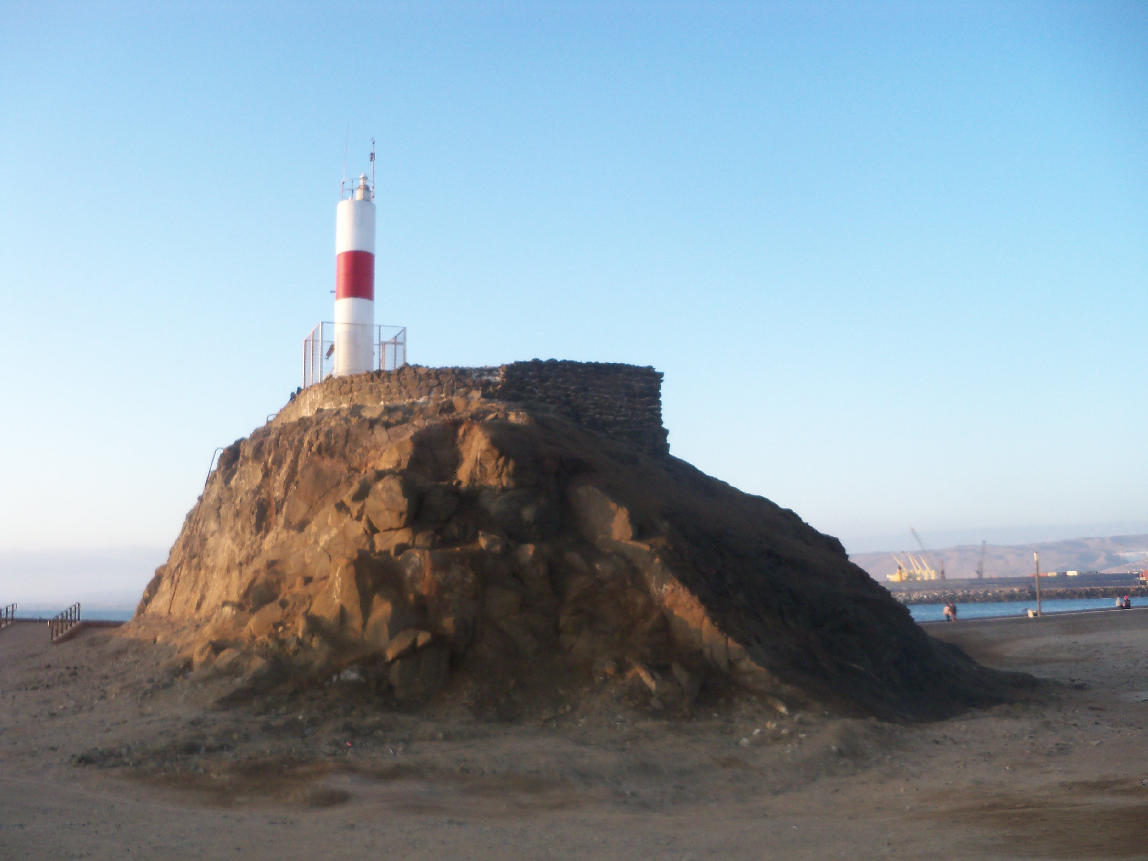
Le phare de la péninsule du Scorpion (en espagnol : Faro Península Alacrán) est un phare actif situé sur la péninsule du Scorpion du port d'Arica (Province d'Arica, dans la Région d'Arica et Parinacota au Chili. Il est géré par le Service hydrographique et océanographique de la marine chilienne.
Book your tour near
Phare de la péninsule du Scorpion
Book Now
4.2
in partnership with
GetYourGuide.com
Gallery

Sponsored
Location
976 m
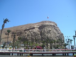
Morro de Arica is a steep hill located in the Chilean city of Arica. Its height is 139 metres above sea level. It was the last bulwark of defense for the Peruvian troops who garrisoned the city during the War of the Pacific. Morro de Arica was assaulted and captured on June 7, 1880, by Chilean troops in the last part of the Tacna and Arica campaign. Morro de Arica rises steeply from the city and the sea, with a more gentle slope towards the east. A giant flag of Chile is flown on its summit. Morro de Arica was declared a national monument on October 6, 1971.

1.2 km
The Port of Arica is the main port of the northernmost coastal Chilean city of Arica. The northern part of the port, known by its acronym, MASP Arica, is operated by the Peruvian State.
It is one of the six most active ports in Chile, alongside those of Iquique, Lirquén, San Antonio, San Vicente and Valparaíso.

1.2 km
Arica is a commune and a port city with a population of 241,653 in the Arica Province of northern Chile's Arica y Parinacota Region. It is Chile's northernmost city, being located only 18 km south of the border with Peru. The city is the capital of both the Arica Province and the Arica and Parinacota Region. Arica is located at the bend of South America's western coast known as the Arica Bend or Arica Elbow. At the location of the city are two valleys that dissect the Atacama Desert converge: Azapa and Lluta. These valleys provide citrus and olives for export.
Arica is an important port for a large inland region of South America. The city serves a free port for Bolivia and manages a substantial part of that country's trade. In addition it is the end station of the Bolivian oil pipeline beginning in Oruro. The city's strategic position is enhanced by being next to the Pan-American Highway, being connected to both Tacna in Peru and La Paz in Bolivia by railroad and being served by an international airport.
Arica has an extremely dry climate, with almost no rainfall. Even so, the frequent maritime winds from the cold waters nearby renders a moderate desert climate. Its mild weather has made Arica known as the "city of the eternal spring" in Chile while its beaches are frequented by Bolivian society. The city was an important port already during Spanish colonial rule. Chile seized the city from Peru in 1880 during the War of the Pacific, being recognized as Chilean by Peru in 1929. A substantial part of African Chileans live in or trace their origins to Arica.

1.3 km
The Casa Bolognesi, also known as the Casa de la Respuesta, is a historical building owned by the Peruvian State located in Arica, Chile. It is the site of a meeting that preceded the Battle of Arica during the War of the Pacific.

1.3 km
The Arica House of Culture, also known as Former Arica Custom House, is a building located in Arica, Chile. Designed by Gustave Eiffel's company, it was built between 1871 and 1874, prior to the annexation of Arica by Chile. The building was declared a National Monument of Chile on November 23, 1977, within the category of Historic Monuments.