


Michałów Land (Polish: Ziemia michałowska, German: Michelauer Land, Latin: Terra Michaloviensis) is a historical region in central Poland, now part of the Kuyavian-Pomeranian Voivodship. During the Middle Ages, it was a disputed territory between the Kingdom of Poland and the State of the Teutonic Order.
Location
985 m
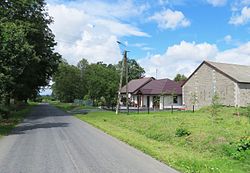
Opalenica [ɔpalɛˈnit͡sa] is a village in the administrative district of Gmina Brodnica, within Brodnica County, Kuyavian-Pomeranian Voivodeship, in north-central Poland.

1.6 km
Kolonia Osiek [kɔˈlɔɲa ˈɔɕɛk] is a village in the administrative district of Gmina Osiek, within Brodnica County, Kuyavian-Pomeranian Voivodeship, in north-central Poland.
2.2 km
Jeziórki [jɛˈʑurki] is a village in the administrative district of Gmina Osiek, within Brodnica County, Kuyavian-Pomeranian Voivodeship, in north-central Poland.

2.2 km
Gorczenica [ɡɔrt͡ʂɛˈnit͡sa] is a village in the administrative district of Gmina Brodnica, within Brodnica County, Kuyavian-Pomeranian Voivodeship, in north-central Poland.
Historically, it belonged to Michałów Land.
2.9 km
Gorczeniczka [ɡɔrt͡ʂɛˈnit͡ʂka] is a village in the administrative district of Gmina Brodnica, within Brodnica County, Kuyavian-Pomeranian Voivodeship, in north-central Poland.