
 English
 Français
Tail of the Bank
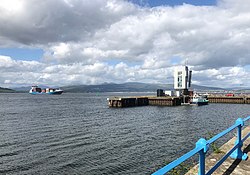
The Tail of the Bank is the name given to the anchorage in the upper Firth of Clyde immediately North of Greenock, between Inverclyde and Argyll and Bute. This area of the Firth gets its name from the deep water immediately to the west of the sandbank which marks the entrance to the navigable channel up the Estuary of the River Clyde.
Nearby Places View Menu

73 m
River Clyde
The River Clyde (Scottish Gaelic: Abhainn Chluaidh, pronounced [ˈavɪɲ ˈxl̪ˠuəj]) is a major river of western Scotland and the third-longest in the country at about 170 kilometres (110 mi) in length. Its river network extends to 4,244 km and drains a basin of 1,903 km2, expanding to 3,854 km2 when the Clyde estuary system with the Kelvin, White Cart, Black Cart and Leven is included. Around 1.79 million people, 33.8% of Scotland's population, live within this catchment. The river rises in the Lowther Hills and flows north-west through South Lanarkshire and Glasgow before entering the Firth of Clyde.
From the late 18th century the upper estuary and river through Glasgow were systematically engineered using groynes, longitudinal training walls and continuous dredging, and by removing rocky obstructions such as a large part of the Elderslie Rock. This was done to enable ocean-going access and support Glasgow's rise as a world centre of shipbuilding and marine engineering in the 19th and 20th centuries.
Since the late 20th century commercial deep-water functions have migrated down the estuary to naturally deep sites at Greenock, Finnart and Hunterston, while the upper river corridor has seen major regeneration in Glasgow. Environmental quality has improved from historic industrial lows, though legacy contaminants and periodic low-oxygen episodes in the outer firth have been reported.

967 m
MV Captayannis
The Captayannis was a Greek sugar-carrying vessel that sank in the Firth of Clyde, Scotland in 1974. Known as the Sugar Boat locally.

1.6 km
Greenock Princes Pier railway station
Greenock Princes Pier was a railway station serving Greenock, Renfrewshire, Scotland, originally as part of the Greenock and Ayrshire Railway. It was approached by a tunnel sloping downhill under Greenock's west end, with railway sidings before the line crossed Brougham Street bridge over the main road to Gourock. The station was set on an embankment on the approach to Prince's Pier, with a line curving down to serve Albert Harbour.
The area of the station, pier and the infilled Albert Harbour is now occupied by Greenock Ocean Terminal container port and cruise ship passenger terminal.

2.0 km
St John the Evangelist's Church, Greenock
St John the Evangelist's Church, Greenock, is located in Union Street, Greenock, Inverclyde, Scotland. It is an active Anglican church in the Scottish Episcopal Church. It is designated by Historic Environment Scotland as a Category B listed building.