


Knarsdale est une ancienne paroisse civile et un village du Northumberland, en Angleterre.
Location
1 explorer visited this place

0 m
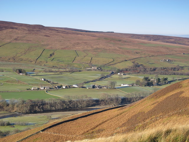
Knarsdale, historically Knaresdale, is a village in the civil parish of Knaresdale with Kirkhaugh, in Northumberland, England about 5 miles north of Alston. The village takes its name from the Knarr Burn: Knarr means 'rugged rock'.

1.0 km
Slaggyford is a village in the civil parish of Knaresdale with Kirkhaugh, in Northumberland, England about 5 miles north of Alston, Cumbria.
It is set in the South Tyne valley. Hadrian's Wall lies to the north of the Tyne Gap. The South Tyne Valley falls within the North Pennines Area of Outstanding Natural Beauty, the second largest of the 40 AONBs in England and Wales. Slaggyford takes its name from the Old English for ‘muddy, dirty ford’, which may originate from quickly moving river water stirring up the river bed at the bottom of a short steep hill, as the river drops from 1,000 feet to 700 feet from Alston to Slaggyford.
The Pennine Way runs through the village on its way northwards from Alston to Greenhead.
The Maiden Way Roman road passes through Slaggyford, with the A689 road following the line of the Roman road for a few hundred yards on the way south out of the village.
1.1 km
Aules Hill Meadows is the name given to a Site of Special Scientific Interest in Northumberland, England. The site, listed since 1992, is a set of four traditionally managed northern hay meadows, now rare in Northumberland.

1.1 km
Slaggyford was historically a railway station on the Alston Line, which ran between Haltwhistle and Alston. The station served the village of Slaggyford in Northumberland.[1]
Located 8+1⁄2 miles from the junction with the Newcastle and Carlisle Railway at Haltwhistle, the station was opened on 21 May 1852 by the North Eastern Railway.
Several unscheduled calling points existed on the section between Slaggyford and Lambley, including Whitwham, Softley, and Burnstones. Trains regularly stopped to allow passengers to board and alight, despite the lack of platforms or facilities at these locations.
After being closed for 42 years, the station reopened in June 2018, as part of the South Tynedale Railway.
1.8 km
Whitfield Moor, Plenmeller and Asholme Commons is a Site of Special Scientific Interest in the North Pennines in Northumberland, England. This protected area is located south of Haltwistle and includes part of the Bellister Castle estate and parts of the Williamston estate and Whitfield estate.
Notes et références
(en) Cet article est partiellement ou en totalité issu de l’article de Wikipédia en anglais intitulé « Knarsdale » (voir la liste des auteurs).