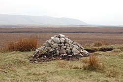
Healey Nab or "The Nab" is an area of countryside owned partly by Lancashire County Council containing rolling hills, moorland, woodland, ponds and streams to the east of Chorley, Lancashire, between the M61 and the West Pennine Moors. To its southeast is Anglezarke Reservoir and to its northeast is White Coppice. The name "Healey Nab" is derived from heagh (high) and ley (woodland). "Nab" is believed to derive from the Middle-English nabb, meaning promontory or headland. The area is popular with walkers; a network of hiking trails criss-crosses it. It has two small human-made lakes: Bottom Lodge, and Top Lodge, a private fishing lake. They used to be linked to Lower Healey Bleach Works, a finishing works of the town's cotton industry, whose remaining structure has been incorporated into the site's conversion into a small industrial estate. The summit is Grey Heights, and near it is a disused quarry known as Devil's Rock. Its highest point is Grey Heights, at 682 feet, with views of Chorley, the skyline of Preston, Fiddlers Ferry power station in Merseyside, Jodrell Bank Telescope, and the silhouette of Blackpool Tower, Blackpool Pleasure Beach and the Irish Sea. From Chorley, "The Nab" dominates the landscape and is the first significant height gain in the transition from a heavily populated area to the moorland of the West Pennine Moors.

Nearby Places View Menu
Location Image
1.3 km

White Coppice

White Coppice is a hamlet near Chorley, Lancashire, England. It was the most populated part of the township of Anglezarke in the 19th century. Close to the settlement in the early 19th century were quarries and small coal mines. The hamlet lies to the north of Anglezarke Reservoir in the Rivington reservoir chain built to provide water for Liverpool in the mid 19th century. To the south west is a hill known as Healey Nab. White Coppice had a cotton mill at the start of the Industrial Revolution. Its mill lodge provided water for a steam engine, and before that the mill was powered by a waterwheel on the Black Brook. Around 1900 the mill was owned by Alfred Ephraim Eccles, a supporter of the Temperance movement.
Location Image
1.6 km

High Bullough Reservoir

High Bullough Reservoir is the oldest of all the reservoirs in the Rivington chain, having been authorised by an Act of Parliament obtained in 1846 and completed in 1850. It was built for Chorley Waterworks by the engineer John Frederick Bateman, who had estimated the cost of the project while working for Edwin Chadwick's Towns Improvement Company, and had then acted as Engineer for the project. The outlet consisted of a pipe running through the dam, and supported by two masonry piers where it ran through the central clay puddle. The outlet valve was at the downstream end of the dam, and although this configuration is no longer thought to be good practice, there have been no serious issues with the reservoir throughout its operational life. The earth dam had a maximum height of 39 feet (12 m), was 988 feet (301 m) long and impounded 55 million imperial gallons (250 Ml) of water. Popular with walkers, it forms part of the Anglezarke trail, although it is also accessible from Manor House. It was originally named Chorley Reservoir. There are a number of websites that state that High Bullough Reservoir is no longer used to supply drinking water, but the reservoir was still contained in a list of reservoirs in the Rivington Chain when United Utilities issued an application for a drought permit to reduce compensation flows to the River Yarrow in mid-2018. A huge staircase, made from timber, was created between the reservoir and nearby Manor House. Known as Jacob's Ladder, the remains can be seen on the east side of the water.
1.6 km

Grain Pole Hill

Grain Pole Hill is a location on Anglezarke Moor, near Chorley, within the West Pennine Moors of Lancashire, England. With a height of 285 metres (935 ft), the summit provides views towards the Irish Sea. It is located between Round Loaf and Pikestones, both of which are Neolithic remnants. Hurst Hill is less than half a mile away.
Location Image
1.6 km

Anglezarke

Anglezarke is a sparsely populated civil parish in the Borough of Chorley in Lancashire, England. It is an agricultural area used for sheep farming and is also the site of reservoirs that were built to supply water to Liverpool. The area has a large expanse of moorland with many public footpaths and bridleways. The area is popular with walkers and tourists; it lies in the West Pennine Moors in Lancashire, sandwiched between the moors of Withnell and Rivington, and is close to the towns of Chorley, Horwich and Darwen. At the 2001 census it had a population of 23, but at the 2011 census the population was included within Heapey civil parish. The area was subjected to depopulation after the reservoirs were built.