


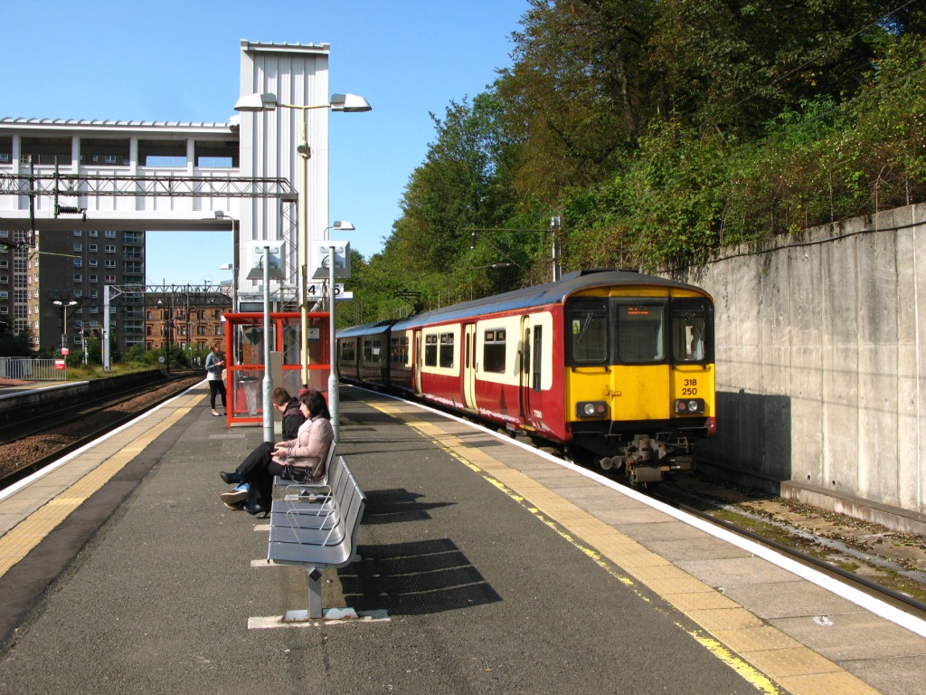
Dalmuir railway station is a railway station serving the Dalmuir area of Clydebank, West Dunbartonshire, Scotland. It is a large, five-platform interchange between the Argyle Line, North Clyde Line and West Highland Line, between Singer and Clydebank (both to the south-east) and Kilpatrick (to the north-west). It is situated 9 miles 71 chains (15.9 km) from Glasgow Queen Street, measured via Westerton and Maryhill.

Location
1 explorer visited this place


History
The original two-platform station opened on 31 May 1858. The station was relocated to its current location in May 1897 by the North British Railway and enlarged to four platforms to accommodate the extension of the Glasgow, Yoker and Clydebank Railway from Clydebank. The station was known as Dalmuir Park between 1952 and 1973. A fifth platform was added as part of the Argyle Line expansion in 1979.
Station layout
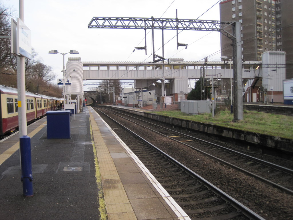
There are four through platforms, two on the Yoker branch and two on the Singer branch along with a terminal bay platform from the Yoker branch. The two inner platforms link up at the north end of the station, where there were formerly two footbridges - one spanning each pair of lines; however these were dismantled after being replaced by a new, fully disability-accessible bridge fitted with three lifts that links all five platforms in 2009.
Passenger Volume
The statistics cover twelve-month periods that start in April.
Services
Dalmuir is a junction station between the North Clyde line to Glasgow Queen Street, and the Argyle line to Glasgow Central, with trains from both stations continuing to serve various destinations further east and south. Both of these lines have access to two separate routes to the city; via Singer or via Yoker, which subsequently rejoin at Hyndland, before splitting again at Partick. Trains originating from Glasgow Central typically terminate here, with those originating from Glasgow Queen Street serving destinations further west. The station is also served by trains to/from the West Highland line, which travel non-stop to Glasgow Queen Street. The station is also served by Caledonian sleeper trains, providing night services to London Euston, and additional trains to the West Highland line.
ScotRail
As of March 2025, the typical off-peak service in trains per hour (tph) and trains per day (tpd) is:
2 tph to Edinburgh Waverley via Glasgow Queen Street (semi-fast) 2 tph to Airdrie via Singer and Glasgow Queen Street 2 tph to Larkhall via Singer, Glasgow Central and Hamilton Central 1 tph to Cumbernauld via Yoker, Glasgow Central and Hamilton Central and Motherwell 1 tph to Motherwell via Yoker, Glasgow Central and Hamilton Central 2 tph to Whifflet via Yoker and Glasgow Central, of which 1 continues to Motherwell 2 tph to Balloch 2 tph to Helensburgh Central 6 tpd to Glasgow Queen Street (non-stop) 6 tpd to Oban, of which 3 have a portion which divides at Crianlarich and runs to Mallaig via Fort William The typical service on Sundays is:
2 tph to Edinburgh Waverley via Singer and Glasgow Queen Street 1 tph to Motherwell via Yoker, Glasgow Central and Whifflet 1 tph to Larkhall via Yoker, Glasgow Central and Hamilton Central 2 tph to Balloch 2 tph to Helensburgh Central 3 tpd to Glasgow Queen Street (non-stop) 3 tpd to Oban, of which 2 have a portion which divides at Crianlarich and runs to Mallaig via Fort William
Caledonian Sleeper
The typical service is:
1 tpd to London Euston via Glasgow Queen Street, Edinburgh Waverley and Crewe, except Saturday evenings 1 tpd to Fort William, except Sunday Mornings