


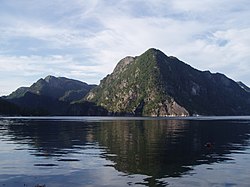
Øyreskjeret, est une île dans le landskap Sunnhordland du comté de Vestland. Elle appartient administrativement à Bjørnafjorden.
Location

7.2 km
Strandvik is a village in Bjørnafjorden Municipality in Vestland county, Norway. The village lies on the northern shore of the Bjørnafjorden, about 10 kilometres east of Osøyro and about the same distance southeast of the village of Fusa. Strandvik Church is located in the village.
7.2 km
Strandvik Church is a parish church of the Church of Norway in Bjørnafjorden Municipality in Vestland county, Norway. It is located in the village of Strandvik. It is one of the churches for the Fusa parish which is part of the Fana prosti in the Diocese of Bjørgvin. The white, wooden church was built in a long church design in 1857 using plans drawn up by the architect Frederik Hannibal Stockfleth. The church seats about 450 people.
7.2 km
Strandvik is a former municipality in the old Hordaland county, Norway. The 143.2-square-kilometre municipality existed from 1903 until its dissolution in 1964. The area is now part of Bjørnafjorden Municipality in the traditional district of Midhordland in Vestland county. The administrative centre was the village of Strandvik where Strandvik Church is located.
Prior to its dissolution in 1964, the 143.2-square-kilometre municipality was the 440th largest by area out of the 689 municipalities in Norway. Strandvik Municipality was the 424th most populous municipality in Norway with a population of about 2,078. The municipality's population density was 14.5 inhabitants per square kilometre and its population had decreased by 10.4% over the previous 10-year period.

11.9 km
Bjørnafjorden is a municipality in Vestland county, Norway. It is located in the Midhordland region of the county. The administrative centre of Bjørnafjorden is the village of Osøyro. Other villages in the municipality include Eikelandsosen, Fusa, Hagavik, Haljem, Holdhus, Holmefjord, Strandvik, Sundvor, Syfteland, Søre Øyane, Søvik, and Vinnes.
The 517.4-square-kilometre municipality is the 204th largest by area out of the 357 municipalities in Norway. Bjørnafjorden Municipality is the 46th most populous municipality in Norway with a population of 26,342. The municipality's population density is 50.9 inhabitants per square kilometre and its population has increased by 15.9% over the previous 10-year period.
12.0 km
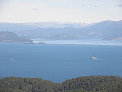
Bjørnafjorden is a fjord in Vestland county, Norway. It runs through Austevoll Municipality, Bjørnafjorden Municipality, and Tysnes Municipality. The large island of Tysnesøya lie along the south side of the Bjørnafjorden and the Bergen Peninsula and the mainland lie along the north and east sides of the fjord. The Fusafjorden split off from the main fjord on the north side by the village of Osøyro. The 30-kilometre fjord is about 10 kilometres wide and its maximum depth is 583 metres below sea level.
Bjørnafjorden Municipality, which was established on 1 January 2020 as a merger between the old Os Municipality and Fusa Municipality, is named after the fjord.