


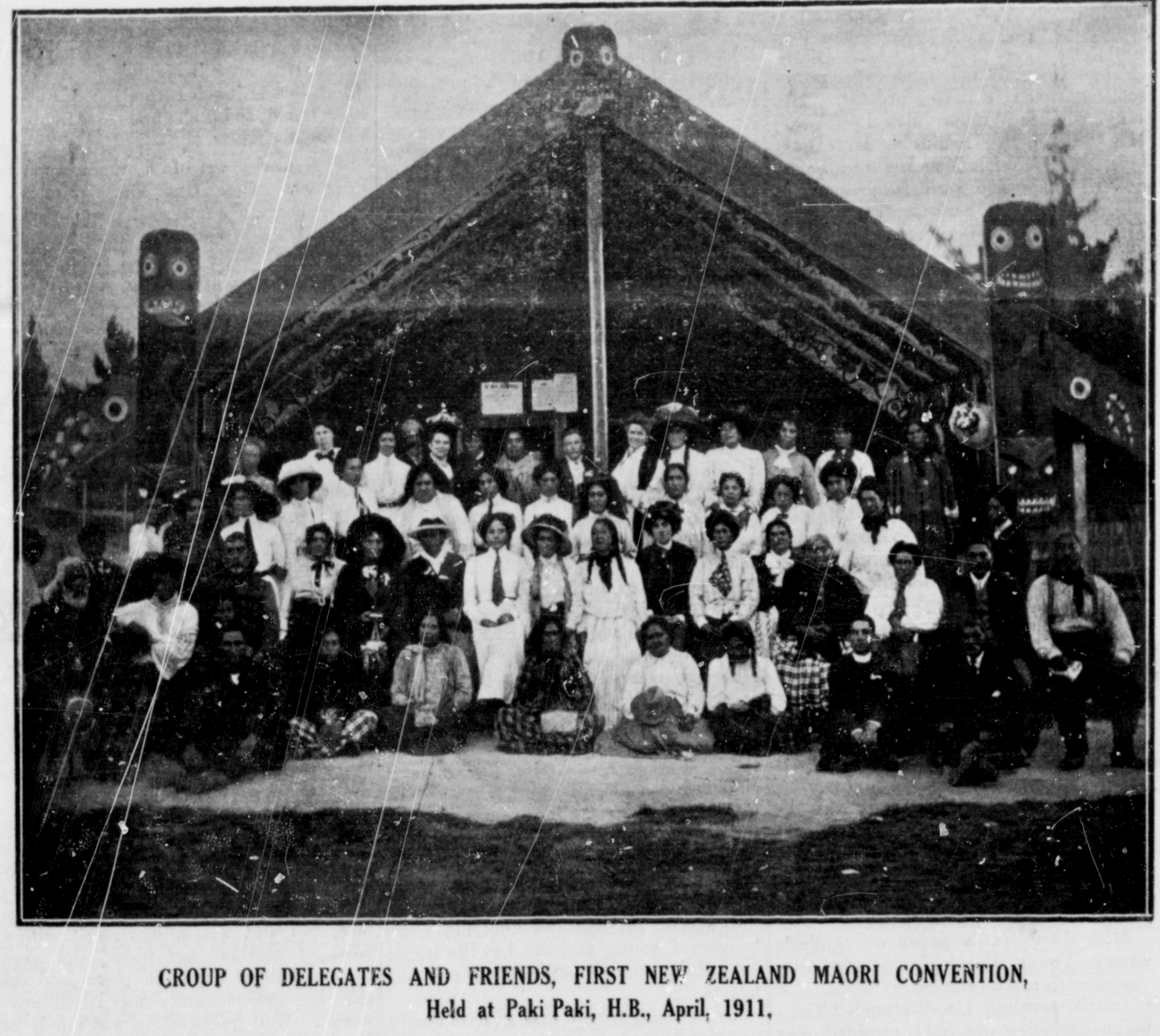
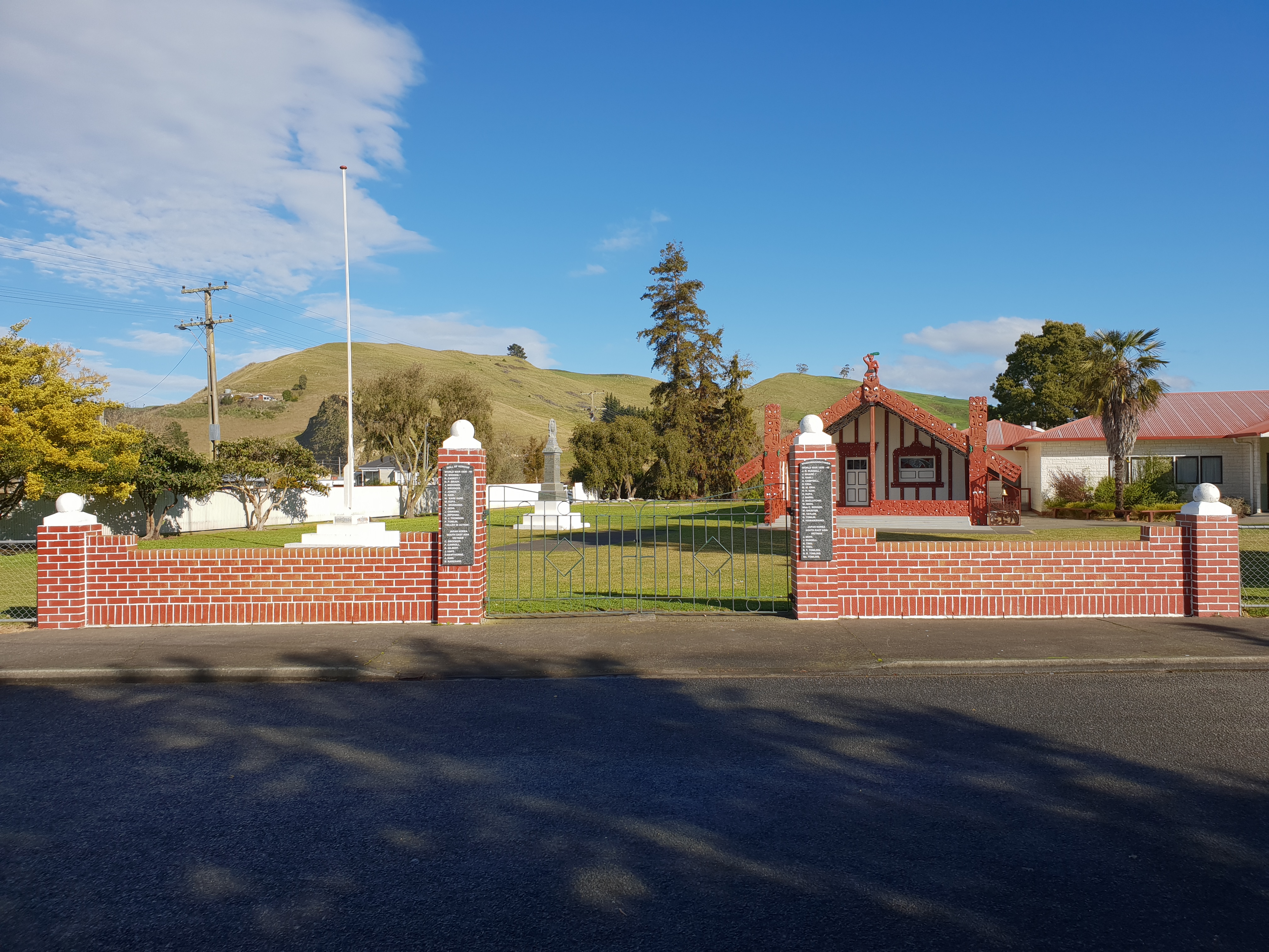
Pakipaki also known as Te Pakipakitanga a Hinetemoa, is a pā kāēnga village and rural community in the Hastings District and Hawke's Bay Region of New Zealand's North Island. The village is home to many Ngāti Whatuiāpiti hapū tribes represented by their three marae of Houngarea, Mihiroa, and Taraia. The village is also the home of the Hawke's Bay Catholic Māori Mission and displays the Foundation Stone for the Catholic Church in Hawke's Bay.
Gallery

Sponsored
Location

3.9 km
Pekapeka Regional Park, also known as Pekapeka Wetland, is a wetland reserve located 12 kilometres by road south of Hastings in the Poukawa Basin of Hawke's Bay, New Zealand.
The Hawke's Bay Regional Council began restoring the wetland in the late 1990s with the removal of willows and the construction of a perimeter fence. The Council initially owned about half of the wetland, but this has been increased to 90%. It is rated as the second most ecologically valuable wetland in Hawke's Bay. The Poukawa Stream, which drains Lake Poukawa in the south-west, runs through the Pekapeka Wetland.

4.9 km
Longlands is a rural community in the Hastings District and Hawke's Bay Region of New Zealand's North Island. The area is on the southern and western outskirts of Hastings city.
The Longlands Estate occupied much of the land around 1880, but was broken up into smaller farms and a freezing works in the early 20th century.
The area is a centre for growing fruit and vegetables.
5.4 km
Hastings Aerodrome is a small airport in Hastings, Hawke's Bay, New Zealand. It is sometimes referred to as Bridge Pa Aerodrome. It is owned and operated by the Hawke's Bay & East Coast Aero Club Inc.
The airport is on the Heretaunga Plains. The settlement of Bridge Pa is close by. The aerodrome is eight kilometres west of the Hastings central business district.
Scheduled airline services in and out of Hawke's Bay are generally handled at the larger nearby Hawke's Bay Airport in Napier.
5.6 km
Bridge Pa is a rural Māori settlement and surrounding area in Hawke's Bay, New Zealand, located approximately 10 kilometres inland from Hastings. The pā itself comprises a school, a meetinghouse of the LDS Church, two marae, a cemetery, a disused quarry, and the 140-year-old historical Homestead of the Kamau family.
Bridge Pa is situated on flat land on the Heretaunga Plains with the major geographical feature of the township being the Karewarewa Stream. Located on the edge of an unconfined aquifer, the surrounding land is free-draining and is used for sheep grazing, horticulture and wine production.
The surrounding area includes Hastings Aerodrome, two golf clubs, a car club, and a Deer Stalkers hall. As well as the main settlement centred on the intersection of Maraekakaho Road and Raukawa Road, a satellite settlement is located on Ngatarawa Road and on State Highway 50. A relatively large tract of the surrounding rural area is also classified as "Bridge Pa" by local authorities and the White Pages.
The main road through the town is limited to 50 km/h and traffic is slowed through a variety of traffic calming measures. There is no sewerage. There is metropolitan style water reticulation. Wastewater is treated via individual homeowner septic tanks.
The rural setting experiences between −3 °C frosts in winter to 40 °C heat in late summer. Bridge Pa is approximately 20 km from the coast, and with the central North Island mountain ranges of the Ruahines and Kawekas to intercept the prevailing westerly winds, the region enjoys a Mediterranean climate with around 2350 sunshine hours per annum and very low humidity.
5.8 km
Hastings Boys' High School is a boys' secondary school in Hastings, New Zealand. The school is part of the Super 8. The school was founded in 1904 as Hastings High School. In 1922, it became Hastings Technical School under the leadership of William Penlington, who remained headmaster until 1949.
In the mid-1950s, the school split into Hastings Girls' High School and Hastings Boys' School. It has four Houses, Te Mata, Heretaunga, Te Kahu and Manu Huia. These houses compete in many sporting events with each other throughout the year.
Students at Hastings Boys' High School organised a conference in 1999 to consider cloning the Huia, their school emblem. The Māori tribe Ngāti Huia agreed, in principle, to support the endeavour, which would be carried out at the University of Otago, and a California-based Internet start-up volunteered $100,000 of funding. The cloning did not ultimately take place.
Pakipaki is a Sacred Space in the Footsteps of Venerable Suzanne Aubert. It is located at the intersection of State Highway 2 and State Highway 50A, south-west of Hastings and Havelock North.