
 English
 Français

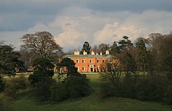
Copt Hewick
Copt Hewick est un village et une paroisse civile du Yorkshire du Nord, en Angleterre.
Nearby Places View Menu
321 m
Copt Hewick
Copt Hewick is a village and civil parish in the county of North Yorkshire, England. The village lies about two miles east of Ripon. It had a population of 180 in 2004 according to the North Yorkshire County Council, increasing to 253 at the 2011 census.
Until 1974 it was part of the West Riding of Yorkshire. From 1974 to 2023 it was part of the Borough of Harrogate, it is now administered by the unitary North Yorkshire Council.
The name of the village derives from the Old English Coppede hēah wīc, which means High specialised farm. The Copt element refers to the hill that the village stands on.
The village is home to Holy Innocents Church, Copt Hewick, which forms a group with a school and clock tower, all built in 1876.

441 m
Holy Innocents Church, Copt Hewick
Holy Innocents Church is an Anglican church in Copt Hewick, a village in North Yorkshire, in England.
Anglican worship in Copt Hewick began in the mid-19th century, in a schoolroom. In 1876, a church was constructed, to a design by W. Lewis and Robert Hargreave Brodrick. It was consecrated by the Bishop of Ripon on 2 August. In 1887, it was dedicated to the Holy Innocents, and that year, the nave was extended, a vestry added, and the roof was replaced. In 1960, new altar rails and a reading desk were installed, and the following year, stained glass was placed in the windows. The church was Grade II listed in 1986.
The church is built of polychromatic brick, with a roof in purple slate with grey bands. It consists of a nave with a south porch, an apsidal chancel with a conical roof, and a north vestry. On the roof is a wooden lantern with a short spire. The west window has two lights, and the other windows are lancets. The porch has a blue brick archway with a wooden head pierced by small quatrefoils. Inside, there are many polychromatic tiles, and there is a chancel screen which can slide into the side walls.

499 m
Bridge Hewick
Bridge Hewick is a village and civil parish in North Yorkshire, England. The village is situated on the River Ure, and approximately 2 miles (3 km) east of the cathedral city of Ripon. The population was recorded at less than 100 at the 2011 Census. Details are included on the statistics of the civil parish of Copt Hewick. North Yorkshire County Council estimate that the population at the 2011 census was 50, which had risen to 60 by 2015.
According to A Dictionary of British Place Names, 'Bridge Hewick' could be derived from the Old English 'brycg' for "at the bridge", with 'heah+wic', meaning a "high or chief dairy-farm". Hewick is recorded in the 1086 Domesday Book as "Heawic", in the Hallikeld Hundred of the West Riding of Yorkshire. Listed for the settlement are three ploughlands and a meadow of one acre. In 1066 the lord of Hewick was Ealdred, Archbishop of York; lordship in 1086, after the Conquest, was held by the following archbishop, Thomas of Bayeux, who was also Tenant-in-chief to King William.
In 1837, Bridge Hewick population was 77. In 1870–02 Bridge Hewick was a township of 867 acres (4 km2) in the civil parish of Ripon, with a population of 89 in 18 houses. A chapel in Bridge Hewick was in 1826 described as "in ruins".
Until 1974 it was part of the West Riding of Yorkshire. From 1974 to 2023 it was part of the Borough of Harrogate, it is now administered by the unitary North Yorkshire Council.
The Bridge Hewick local public house is the Black-A-Moor Inn. The Bridge over the River Ure is the starting point of a circular walk around Ripon known as the Sanctuary Way Walk.

1.1 km
River Skell
The River Skell is a 12-mile-long (19 km)
tributary of the River Ure in North Yorkshire, England.
Its source is in boggy ground on moorland 2 miles (3 km) north of Pateley Bridge. For its first 2 miles (3 km) the river is known as Skell Beck. Descending from the moor the river enters Skell Gill, a narrow wooded valley. The river valley gradually broadens, but remains well wooded, passing the village of Grantley and the 17th century Grantley Hall.
The river enters Studley Royal Park and flows past Fountains Hall and the ruins of Fountains Abbey. Below the abbey the river was dammed in the 18th century to form an ornamental lake and water garden. Downstream from the park the river bed is porous rock that allows some or all of the flow to disappear underground. After this, the river re-emerges on the surface and enters the city of Ripon, and on the outskirts receives its largest tributary, the River Laver. The Skell enters the River Ure 0.5 miles (1 km) east of the centre of Ripon.
The name is from the Old Norse skjallr, meaning "resounding", from its swift and noisy course. In the Middle Ages the river was known as "Heaven Water", presumably from its association with Fountains Abbey.
The flow of the River Skell has been measured at Alma Weir in Ripon, near to its confluence with the Ure since 1984. The thirty year record shows that the catchment of 120 square kilometres (46 sq mi) to the gauging station yields an average flow of 1.54 cubic metres per second (54 cu ft/s).
In June 2007 the highest river level was recorded of 1.8 metres (5 ft 11 in) over the weir, which was estimated to have a flow of 103 cubic metres per second (3,600 cu ft/s).
1.5 km
Sharow
Sharow is a village and civil parish in the county of North Yorkshire, England. It is about 1 mile (1.6 km) north-east of Ripon. The name Sharow derives from the Old English of 'Scearu' and 'Hōh' which translates as boundary hill-spur or a share/division of a sharply projecting piece of land. In the 2001 Census, the village was registered as having a population of 546, which had risen slightly to 556 at the 2011 Census. In 2015, North Yorkshire County Council estimated the population to have dropped to 540.
Until 1974 it was part of the West Riding of Yorkshire. From 1974 to 2023 it was part of the Borough of Harrogate, it is now administered by the unitary North Yorkshire Council.
The village has a Church of England primary school which was rated as 'Good' by Ofsted in 2016 after previously being listed as 'Requires Improvement' in 2014. St John's Church, Sharow gained Eco-Status in 2017, the fifth one in the Diocese of Leeds to be awarded such status. The church's 2-acre (0.81 ha) churchyard has been managed effectively since 1992 and now is home to a selection of rare plant life, animals and insects. The church hit the headlines in June 2011 when a group of bellringers from Oxfordshire were locked in the church's tower by an irate local due to the noise they were creating. The group were released when a passer-by was alerted to their predicament.
The village has a pub (The Half Moon – now closed), Sharow Hall (which is not open to the public) and the remains of Sharow Cross, a sanctuary cross which signified that the traveller was within 1 mile (1.6 km) of the monastery in Ripon and therefore granted sanctuary. The cross is now a grade II* listed structure, and is one of the trail heads for the Sanctuary Way Walk. During the 19th century, the Archbishop of York was the lord of the manor.
Sharow currently has three Saturday cricket teams that play in the Nidderdale Amateur Cricket League. The teams play in the 2nd, 6th and 9th divisions, there are also two Wednesday evening teams who play in the Nidderdale Amateur Evening League and the Harrogate and District Evening League Division 7.