Location Image

Farleton, Cumbria

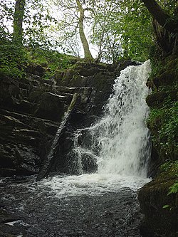
Farleton is a village and former civil parish, now in the parish of Beetham, in the Westmorland and Furness local government district, Cumbria, England. In 1931 the parish had a population of 67. Historically within the county of Westmorland, Farleton lies near Milnthorpe, just to the east of the main A6070 road, from which it is divided by the Lancaster Canal, some 8+1⁄2 miles (13.7 km) south of Kendal. Farleton used to have one public house called 'the Duke' after the Grand Old Duke of York but this was turned into a dwelling house in the early part of the twentieth century. With Farleton there is a small river and one post box. There is also a limestone kiln and the remains of a limestone quarry. Farleton was formerly a township in Beetham parish, from 1866 Farleton was a civil parish in its own right until it was abolished on 1 April 1935 and merged with Beetham.

Nearby Places View Menu
Location Image
1.5 km

Farleton Knott

Farleton Knott is a Site of Special Scientific Interest (SSSI) in Cumbria, England. It is located 6km west of Kirkby Lonsdale, near Farleton. This protected area includes an exceptional limestone pavement on the top of a hill called Farleton Fell. Farleton Knott SSSI includes within its boundary Newbiggin Crags, Holme Park Fell and a National Nature Reserve called Clawthorpe Fell (Clawthorpe Fell is an island of limestone pavement within a quarry called Holme Park Quarry).
Location Image
1.6 km

Peasey Beck

Peasey Beck is a 19.6-kilometre-long (12.2 mi) beck flowing through Cumbria, England. It rises on Lambrigg Fell where it is known as the Sparishaw Beck, flows through Killington Reservoir and converges with Stainton Beck to form the River Bela at Milnthorpe. Prior to 1913, it was known as the River Beela throughout its length.
Location Image
1.6 km

Stainton Beck

Stainton Beck is a watercourse in Cumbria, England. Its upper reaches are known as St. Sunday's Beck.
Location Image
2.0 km

Lupton, Cumbria

Lupton is a linear village and civil parish in the Westmorland and Furness district of Cumbria, England, along the main A65 road north west of Kirkby Lonsdale, 2.3 miles (3.7 km) from the village of Hutton Roof. In the 2001 census the parish had a population of 165, decreasing slightly at the 2011 census to 162. As well as All Saints Church, the village has a public house, the Plough. Lupton Tower is an 18th-century house now used as a corporate head office.