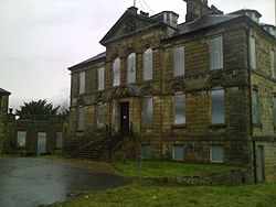
Wardpark is an industrial estate in Cumbernauld, Scotland split by the M80 motorway. The former Burroughs factory, the first factory of Cumbernauld new town, was reoccupied by OKI but was demolished to make way for Westway Retail Park, OKI having been relocated to Westfield. Warkpark is divided into three areas: Wardpark South, on the Abronhill side of the M80; Wardpark North on the Westerwood side; and Wardpark East which next to it and adjacent to Castlecary village. On the aerial photo the yellow building is part of the Wardpark Studios where the Outlander TV series is made. It is just north of the Westway Retail Park. This film company have plans to expand in 2018. John G Russell Transport Limited bought one of the largest warehouses, at 5 Wardpark, early in 2018. Other businesses in Wardpark North include Teledyne Technologies, Aspen Solutions Ltd Corporate Insignia Limited, Thermaflow Ltd, Coilcraft Europe Limited, and Masonry Solutions Ltd. Wardpark South accommodates: Markon Limited, Moulded Foams (Scotland) Ltd., Northwest Plant Limited Wardpark East accommodates: Coronet Services Limited, Polyglass (GB) Limited, Cumbernauld Airport is at the northern edge of Wardpark with views down the Strathkelvin valley. The country road to the north has been blocked to motor vehicles and crosses the Antonine Wall and the main Glasgow-Edinburgh railway line before leading to the Forth and Clyde canal.

Nearby Places View Menu
Location Image
669 m

Cumbernauld Airport

Cumbernauld Airport (ICAO: EGPG, FAA LID: CBN) is a general aviation airport located 16 NM (30 km; 18 mi) northeast of Glasgow at Cumbernauld in North Lanarkshire, Scotland. It serves as an important reliever airport for Glasgow Airport and Edinburgh Airport. Users of Cumbernauld include primarily the training of fixed wing and rotary wing pilots; it also boasts a helicopter charter company and a light aircraft charter operation along with aircraft maintenance facility. Cumbernauld Aerodrome has a CAA Ordinary Licence (Number P827) that allows flights for the public transport of passengers or for flying instruction as authorised by the licensee (Cormack Aircraft Services Limited).
Location Image
1.3 km

Castlecary

Castlecary () is a small historic village in North Lanarkshire, Scotland, directly adjacent to the border with Falkirk. It has long been associated with infrastructure, being adjacent to a bridged river, a Roman fort and roads, a nationwide canal, a Victorian railway viaduct, and a modern motorway. Castlecary is close to the town of Cumbernauld but like Dullatur and Luggiebank is not officially part of the town. Around 1725, the barony of Castlecary, with a population of just seventeen families, was disjoined from the parish of Falkirk, and annexed to Cumbernauld quoad sacra. Castlecary is also near Allandale which, though in the Falkirk council area, was built for Castlecary fireclay workers.
Location Image
1.3 km

Castle Cary Castle

Castle Cary Castle (sometimes called Castlecary Castle) is a fifteenth-century tower house near Castlecary, about 6 miles (10 km) from Falkirk in Scotland. It is less than 3 miles from Cumbernauld Village. It is located near to the site of one of the principal Roman forts of the Antonine Wall.
Location Image
1.4 km

Cumbernauld House

Cumbernauld House is an 18th-century country house located in Cumbernauld, Scotland. It is located near in the Cumbernauld Glen, close to Cumbernauld Village, at grid reference NS772759. The house is situated on the site of (former) Cumbernauld Castle, which was besieged by General Monck in 1651. It was built in 1731, to designs by William Adam (1689–1748), for John Fleming, 6th Earl of Wigtown. In the later 20th century the house was used as offices, first by Cumbernauld Development Corporation, then North Lanarkshire Council, and latterly by DH Morris, who went into liquidation in March 2007. The building lay empty for a decade until it was developed into luxury apartments. Cumbernauld House is a category A listed building.