Location Image

Route A6136 (Grande-Bretagne)

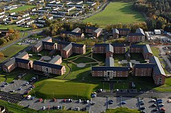
La A6136 est une route à de type A à 4 chiffres située dans le North Yorkshire, en Angleterre. Elle débute dans la ville commerçante de Richmond sous le nom de "Station Road" (il s’agit de l’ancienne gare qui était présente sur cette route). Ensuite, elle traverse la banlieue de Richmond. En traversant des bois clairsemés, elle pénètre rapidement dans la banlieue d’une autre ville, la garnison de Catterick ; c'est la route principale qui traverse la ville. La route traverse le centre-ville de la garnison et ses banlieues, Colburn et Walkerville. Juste après avoir quitté Walkerville, elle traverse la route A1 en se séparant dans deux directions : la direction sud en direction du village de Catterick et la direction nord en direction de Brompton-on-Swale.

Avec la réfection de l'A1 (M) de Leeming à Barton, la A6136 croise maintenant la route d'accès local A6055 à l'ouest de l'autoroute et traverse un nouveau pont qui remplace l'ancien pont du Fort. Les routes A6055 et A6136 forment ensemble la route A6055 qui traverse le pont Catterick et utilise l’ancien croisement nord de l’A1 pour former une nouveau LAR (Local Access Road ou route d'accès locale) du côté ouest de l'autoroute. La partie nord de cette route reliera la route A6108 juste au sud de Scotch Corner. L'ancienne bifurcation sud du pont Catterick à la caserne de la Marne est désormais une route non classifiée. L'ancien pont de chemin de fer du Fort a été retiré intact et doit être utilisé par le chemin de fer de Wensleydale pour combler une brèche juste à l'ouest de la gare de Redmire.

Nearby Places View Menu
Location Image
0 m

A6136 road

The A6136 is a 4 digit A road in North Yorkshire, England. It runs between the A6108 Queen's Road, in the market town of Richmond, before terminating on the A6055 in Catterick, near the A1(M) Junction 52.
79 m

Former Sandes Soldiers' Home

The Former Sandes Soldiers' Home, is a grade II* listed building within Catterick Garrison, North Yorkshire, England. Historic England stated that the building had been grade II* listed due to its "architectural quality and its historical association with Elise Sandes". The awarding of the grade II* status places it in the top 8% of buildings listed by Historic England.
90 m

Catterick Camp railway station

Catterick Camp railway station was a railway station in North Yorkshire, England. It was built as the terminus of the sub branch of the Eryholme-Richmond branch line to serve Catterick Camp, now Catterick Garrison. Along with the rest of the stations on the branch it was closed in 1964, but the line remained open until December 1969. The station had one narrow platform, and at the eastern end was a red-brick ticket office which was 18 feet (5.5 m) long. The original platform was made from wood, but was rebuilt in brick by Italian prisoners of war in 1943. On 15 September 1917, a set of carriages ran away from the station and were derailed. According to the Darlington & Stockton Times of 22 September 1917, four soldiers were killed although one report claims three people were killed.
387 m

Garrison FM

Garrison FM was a network of radio stations in the United Kingdom serving British Army bases around the country between 2001 and 2013. The stations broadcast a mixture of music, news, and chat, their emphasis being to bring news of military-related issues to soldiers and their families, as well as the wider public in general. The stations' licences were taken over by the British Forces Broadcasting Service in 2013.
Location Image
498 m

Catterick Garrison

Catterick Garrison is a major garrison and military town 3 miles (5 km) south of Richmond, North Yorkshire, England. It is the largest British Army garrison in the world, with a population of around 14,000 in 2021 and covering over 2,400 acres (about 10 km2).