


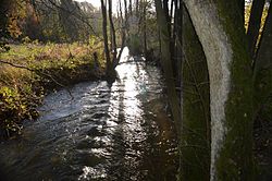
L’arrondissement administratif de Verviers est un des quatre arrondissements administratifs de la province de Liège en Région wallonne (Belgique). Plus grand arrondissement administratif de Belgique, sa superficie est de 2 009,60 km2. Sa population au 1er janvier 2025 s’élevait à 291 525 habitants, soit une densité de 145,1 habitants/km². C'est dans cet arrondissement que se situe la Communauté germanophone de Belgique.
Book your tour near
Arrondissement administratif de Verviers
Book Now
4.6
in partnership with
GetYourGuide.com
Location
1 explorer visited this place

0 m
The Arrondissement of Verviers is one of the four administrative arrondissements in the Walloon province of Liège, Belgium. It includes all the 9 municipalities of the German-speaking Community, while the remaining 20 municipalities in the Arrondissement of Verviers are part of the French-speaking Community.
The Administrative Arrondissement of Verviers consists of the following municipalities:

4.9 km
The Baraque Michel is a locality in the municipality Jalhay, in the High Fens, Wallonia. Before the annexation of the Eastern Cantons by Belgium in 1919, it was the highest point of Belgium. Now it is the third highest point at 674 metres, after the nearby Signal de Botrange) and the Weißer Stein).
The Baraque itself is an inn and the starting point of many excursions. The Baraque Michel was founded between 1811 and 1813 by Michel Schmitz, of Herbiester, already as an inn, but also as refuge for stray travellers: a bell was sounded there during fog, which allowed the rescue of more than one hundred people during the 19th century.
The establishment was also used as relay for the mail coaches, that connected the two then Prussian towns of Eupen and Malmedy. The direct connection was partly through Belgian territory, along the current N68 road.
Several rivers of Belgium, part of the basin of Vesdre, take their source in the vicinity. The principal ones are Gileppe, Hoëgne and Helle.

5.0 km
Sart-lez-Spa is a village of Wallonia and a district of the municipality of Jalhay, located in the province of Liège, Belgium.
Nearby is the river Hoëgne, a tributary of the river Vesdre.
It was a municipality before the fusion of the Belgian municipalities in 1977.

6.0 km
Xhoffraixɔfʀɛ]]; Walloon: Xhofrai [Hofrê or Hyofrê pronounced [hɔ.'fʀɛː] ]) is a village of Wallonia in the municipality of Malmedy, district of Bévercé, located in the province of Liège, Belgium.
Xhoffraix is located in the foothills of the High Fens region, along a national road connecting Malmedy to Signal de Botrange.
Les communes francophones font partie de l'arrondissement judiciaire de Liège alors que les communes germanophones font partie de l'arrondissement judiciaire d'Eupen.