


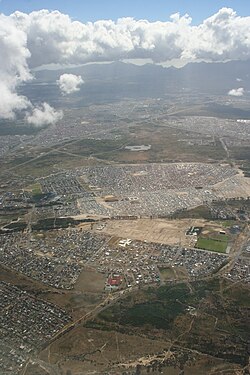
Mfuleni (signifie par la rivière en xhosa) est un township de la métropole du Cap, situé à l'est de la ville du Cap.
Gallery


Sponsored
Location
1 explorer visited this place

0 m
Mfuleni is a relatively new township about 32 kilometres from central Cape Town, South Africa. It is a predominantly Black township, although there are also some Coloured members of the community.
Mfuleni is a suburb of Blue Downs area and is close to the sprawling township of Khayelitsha and also next to the new suburb of Malibu Village. Around 52,300 people live in this township. Most were moved there from the late 1990s following flooding and fires in different townships across the Western Cape, such as Philippi, Nyanga and Khayelitsha. Hence, the mixed nature of the community here. Unemployment, HIV/AIDS and crime are some of the most pressing problems in this poor township.
Recently, the Department of Local government and Housing with its partners established a new housing project which built an additional 165 houses.

1.0 km
The Cape Flats is an expansive, low-lying, flat area situated to the southeast of the central business district of Cape Town. The Cape Flats is also the name of an administrative region of the City of Cape Town, which lies within the larger geographical area.
2.1 km
Blue Downs is a town in the Western Cape, South Africa. It forms part of the Eastern Suburbs Zone of the City of Cape Town situated on the eastern outskirts of the city and is also located on the Cape Flats, a flat expanse of land east of Cape Town.
The suburb is one of the outlying areas of Cape Town that has been targeted by the Western Cape provincial government for development. Planned developments include improved public transportation for the area and the building of additional schools.
3.3 km
The Khayelitsha tavern shooting was a mass shooting which occurred on the morning of 8 March 2020, killing seven people and injuring a further seven people.
3.8 km
Eerste River is a town in the Western Cape, South Africa and a suburb of the City of Cape Town. It forms part of the Eastern Suburbs zone of the city situated behind the Stellenbosch/Vlaeberg Hills on the eastern outskirts of the metropolitan area.
It lies on the R102 about 40 km from Cape Town and 8 km from Cape Town International Airport on the N2 route.
Eerste River started off as many different farms and expanded vastly after the 1980s. It is a diverse town; many of its almost 40,000 residents originally immigrated here from elsewhere. Among its beauty is the area called Penhill, hidden from the town and filled with nature.
Schools in Eerste River include the Afrikaans-medium Eersterivier Secondary School. Other schools in the area include R R Franks Primary, Forest Heights Primary School, Palm Park Primary School, Stratford Primary School, Spurwing Primary School, Tuscany Glen Primary School, Melton Primary School, Helderkruin Primary School, Tuscany High School, Forest Heights High School, and in the surrounding areas Kleinvlei High School and Malibu High School.
Population statistics indicate that the suburb has close to 40,000 residents, but other estimates are closer to 52,000 when Kleinvlei, Palm Park and Penhill are included to the municipality - which are all still considered suburbs of Eerste River by locals and many visitors alike.
Delft, Blackheath, Wesbank and Brentwood Park used to be a part of the town, but as the towns grew, all were given their own municipalities.