


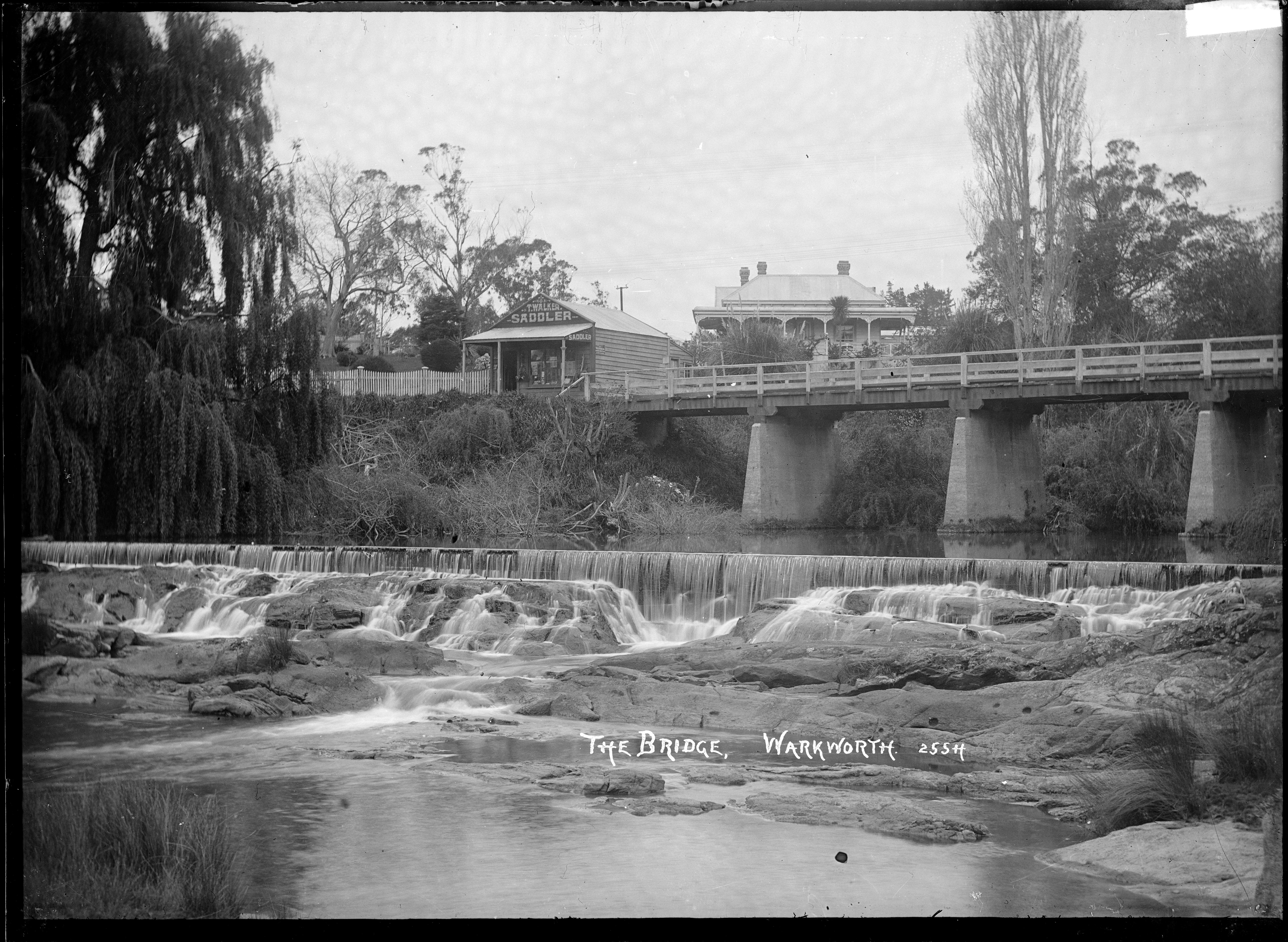
The Mahurangi River in northern New Zealand flows through the town of Warkworth and into Mahurangi Harbour, which opens into the outer Hauraki Gulf. The Left Branch of the river rises in the Dome and flows through the Dome Valley, while the Right Branch rises on Moir Hill. The lower part is a tidal estuary that ranges in depth from below approximately 50 centimetres (20 inches) at the channel entrance to approximately 150 centimetres (59 inches) further upstream.
Gallery


Sponsored
Location
1 explorer visited this place

2.5 km
Mahurangi Harbour is a natural harbour in New Zealand. It is located on the north-eastern coast of the Auckland Region near the town of Warkworth, and empties into the Hauraki Gulf.
2.8 km
Mahurangi Peninsula is a landform in the Rodney Local Board Area in the Auckland Region of New Zealand's North Island. It is located between two bodies of water: the Mahurangi Harbour and Kawau Bay.
5.0 km
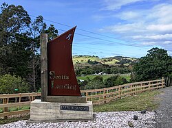
Scotts Landing, also called Mahurangi East, is a rural settlement in the Auckland Region of New Zealand. It is at the end of a narrow peninsula on the eastern side of Mahurangi Harbour. Algies Bay is to the north.

5.6 km
Casnell Island is an uninhabited island located in the Mahurangi Harbour, Auckland Region, New Zealand. Casnell Island is managed by the Department of Conservation.

5.8 km
The Te Kapa River is on the Mahurangi Peninsula in the Auckland Region of New Zealand's North Island. It runs into the Mahurangi Harbour.
The Mahurangi Harbour provides a sheltered anchorage for private pleasure craft in all weathers.
Book your tour near
Mahurangi River
Book Now
4.3
in partnership with
GetYourGuide.com