
 English
 Français

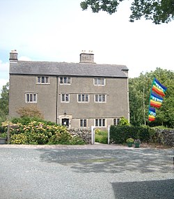
Urswick
Urswick est un village et une paroisse civile de Cumbria, situé dans le nord-ouest de l'Angleterre.
Nearby Places View Menu
555 m
Heaning Wood Bone Cave
Heaning Wood Bone Cave is a cave of archaeological importance in Great Urswick, Cumbria, England.
The cave was first excavated by Holland in 1958, when he found Bronze Age pottery, human and animal bones, and a stone-flake knife of Langdale stone.
In January 2023 it was reported that human bone and a periwinkle shell bead, found in the cave by local archaeologist Martin Stables, had been dated to 11,000 years ago, making it one of the earliest identified locations for human presence in the north of England. At least eight individuals had been buried in the cave, from the early Bronze Age (4,000 years ago), the early Neolithic period (6,000 years ago) and the early Mesolithic period (11,000 years ago).

988 m
St Mary and St Michael's Church, Great Urswick
St Mary and St Michael's Church is in the village of Great Urswick, Cumbria, England. It is an active Anglican parish church in the deanery of Furness, the archdeaconry of Westmorland and Furness, and the diocese of Carlisle. Its benefice is united with those of St Cuthbert, Aldingham, St Matthew, Dendron, and St Michael, Rampside. These churches are part of a group known as the Low Furness Group of Parishes. The church is recorded in the National Heritage List for England as a designated Grade I listed building.
1.0 km
Urswick
Urswick is a civil parish that includes the villages of Great Urswick and Little Urswick. It is located in the Furness area of Cumbria, England. The villages are situated to the south-west of the town of Ulverston. In the 2001 census the parish had a population of 351, decreasing at the 2011 census to 1,397.
Great Urswick is situated along the north and west sides of Urswick Tarn, a small body of water (c. 1100 feet by 600), although the largest such natural body in Low Furness. The tarn is fed from the surrounding hills and feeds Gleaston Beck to the south, the water is said to have a red hue due to the iron content of the surrounding land. Little Urswick, the smaller of the two settlements, stands further south on the lower slopes of a limestone outcrop known as Bolton Heads.

1.5 km
Birkrigg
Birkrigg or Birkrigg Common is an open-area of limestone countryside near the town of Ulverston on the Furness Peninsula in southern Cumbria, England. There is extensive limestone pavement on Birkrigg, which is protected under The Wildlife and Countryside Act 1981. Birkrigg's peak is at 136 metres (446 ft), but its position as the high point on the east of the Furness Peninsula affords it extensive views to the Lake District, Yorkshire Dales, Howgills and across Morecambe Bay to Blackpool.
Birkrigg has a long history of human inhabitation, and the common contains Birkrigg stone circle, a Bronze Age stone circle which is a scheduled monument. Other scheduled monuments on Birkrigg are three round cairns and a "prehistoric enclosed hut circle settlement, an associated enclosure, and a bowl barrow".
Birkrigg is land common to the parishes of Aldingham and Urswick, and has been in public ownership since the sixteenth century. Today, Birkrigg is a popular recreation site crossed by several footpaths and bridleways.
1.9 km
Swarthmoor
Swarthmoor is a small village near Ulverston, in Cumbria, England. Located on the Furness peninsula, it was historically part of Lancashire.