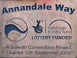
The Annandale Way is a 90-kilometre (56 mi) hiking trail in Scotland, which is officially designated by NatureScot as one of Scotland's Great Trails. It follows the valley of the River Annan from its source in the Moffat Hills to the sea in the Solway Firth south of the town of Annan. The route, which was established on 12 September 2009, has been designed to be traversable in four to five days as a continuous walk but it also offers several day-walks. Overnight stops can be arranged in small market towns and villages along the route such as Moffat, Johnstonebridge, Lochmaben, Lockerbie, or Annan. The route has been developed by Sulwath Connections and local communities, with the support of local estates and farmers, to help promote Annandale as a new area for walking. Its trailheads are near the Devil's Beef Tub in the Moffat Hills and on the Solway Firth just south of Annan, in Newbie.

Nearby Places View Menu
910 m

Corncockle Quarry

Corncockle Quarry was a large and historically important sandstone quarry near Templand in Dumfries and Galloway, Scotland. Stone from here was used in the late Victorian era to build tenements in Edinburgh and Glasgow, and also to construct New York 'brownstones'.
Location Image
1.6 km

Templand

Templand is a village in Dumfriesshire, Scotland, located around 4.5 miles (7.2 km) northwest of Lockerbie. Templand was built during the Industrial Revolution, with the nearby Corncockle Quarry used for quarrying red sandstone to central Scotland and beyond. Stone from the quarry was used in the construction of the Kelvingrove Art Gallery and Museum in Glasgow and was quarried for the refurbishment of the gallery completed in 2006. At its height of activity up to the 1930s it had its own mineral line from what is now the West Coast Mainline and up to 6 trains per week of stone were moved to Glasgow, throughout Scotland. Templand lies between the Corncockle woodland, a marsh, and the Kinnel Water. Geographically it is believed that the entire Templand area is on a massive slab of sandstone, due to the Annan river carrying sand down from the Moffat area.
Location Image
2.2 km

Millhousebridge

Millhousebridge (Scottish Gaelic: Drochaid a' Mhuilinn) is a village in Dumfries and Galloway, Scotland. Millhousebridge is centrally located between Lochmaben and Lockerbie in Dumfries and Galloway. Generally, both towns are within a 3 to 5-mile radius of the hamlet, making it a short drive or cycle from either.
3.0 km

Nethercleugh railway station

Nethercleugh railway station was a station which served the rural area around Nethercleugh and the estate of Jardine Hall, 3 miles north of Lockerbie in Applegarth parish, Scottish county of Dumfries and Galloway. It was served by local trains on what is now known as the West Coast Main Line. The nearest station for Nethercleugh is now at Lockerbie.