
 English
 Français

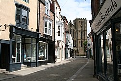
Sessay railway station
Sessay railway station served the village of Sessay, North Yorkshire, England from 1841 to 1964 on the East Coast Main Line.
Nearby Places View Menu

1.1 km
St John's Church, Dalton
St John's Church is an Anglican church in Dalton, near Thirsk in North Yorkshire, in England.
The church was constructed on the initiative of Mary Isabel Dawnay, to a design by William Butterfield, and was completed in 1868. It was originally a chapel of ease to St Columba's Church, Topcliffe. It was grade II* listed in 1988.
The church is built of stone with a Welsh slate roof, and it consists of a nave with a south porch, a chancel with a south transept and a north vestry, and a slim west bellcote tower. The tower contains a lancet window with a hood mould, and a sill band. The upper stage, which is corbelled inwards, has a clock face, and it rises to become octagonal with four lancet bell openings. Above this is an eaves band and a spirelet. The windows in the body of the church are cusped lancets.
Inside the church, there is red brick, with bands of stone and blue brick. There is much polychromatic decoration, particularly in the chancel. There is a timber rood screen, and a reredos of marble and coloured stone. There is a brass chandelier in the chancel, and a stone font in the nave, both designed by Butterfield. The stained glass is by Morris & Co., with Saint John the Evangelist in the west window, Christ and angels in the east window, and the Annunication in the north window of the chancel.

1.2 km
Sessay
Sessay is a small linear village and civil parish in North Yorkshire, England. It is situated approximately 4 miles (6 km) south-east from Thirsk, and 2 miles (3 km) west from the A19 road close to the East Coast Main Line.
The civil parish also includes the village of Little Sessay, where the parish church and school are located. In 2013 the population of the civil parish was estimated at 320. The 2001 UK Census recorded the population as 311 of which 266 were over sixteen years old. There were 130 dwellings of which 90 were detached.
1.6 km
North Yorkshire (district)
North Yorkshire is a unitary authority area in the ceremonial county of North Yorkshire, England. It covers the majority of the North York Moors, the Vale of Mowbray and Vale of York, and the Yorkshire Dales. It does not include the north-east of the ceremonial county or the unitary authority area of York. The largest settlement is Harrogate, and the administrative centre is Northallerton. North Yorkshire is the largest local government area in England, with an area of 3,103 square miles (8,037 km2).
The unitary authority area was formed on 1 April 2023 during a local government restructure. Prior to this, North Yorkshire was a non-metropolitan county containing seven non-metropolitan districts, and was governed by a county council and seven district councils. The creation of the unitary authority area was achieved by abolishing the seven districts and their councils, creating a new district covering the entire area of the non-metropolitan county, and giving North Yorkshire County Council the responsibilities of a district council in addition to its existing county council responsibilities. The county council chose to rename itself North Yorkshire Council as part of the restructure. The first elections to the reconstituted authority took place on 5 May 2022, and it took on district council responsibilities on 1 April 2023.

1.6 km
Dalton, east North Yorkshire
Dalton is a village and civil parish in the county of North Yorkshire, England. It is about 4 miles (6.4 km) south of Thirsk and near the A168 road. It mainly consists of farmland as well as an industrial estate. It has a population of 518.