
 English
 Français

Spion Kop Cemetery
Spion Kop Cemetery, originally known as Hartlepool Cemetery, is a disused cemetery on the coast in Hartlepool in England. It was opened in 1856 to replace St Hilda's Church, Hartlepool churchyard and designed by John Dobson. The area took its name from the Battle of Spion Kop in 1900 during the Boer War. The cemetery was formed from a combination of sand dune and ship's ballast. It is closed to new burials and is now managed as a local nature reserve. Species found there include thrift, the pyramidal orchid, and the lesser meadow-rue.
Nearby Places View Menu

210 m
Hartlepool Rovers
Hartlepool Rovers F.C. are a rugby union club who play at The New Friarage, West View Road in Hartlepool. The club plays in Counties 1 Durham & Northumberland, the seventh tier of the English rugby union system after being relegated from North One East at the end of the 2010–11 season. They have won the Durham Senior Cup a record 45 times.
Hartlepool Rovers club colours are red, white and black, usually consisting of a white shirt, black shorts and red socks.
1.3 km
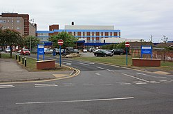
University Hospital of Hartlepool
The University Hospital of Hartlepool is a general hospital in Hartlepool, England. It provides healthcare to people living in southeast Durham. It is managed by the North Tees and Hartlepool NHS Foundation Trust.
1.3 km
Dyke House Academy
Dyke House Academy (formerly Dyke House Secondary Modern School, Dyke House Comprehensive School and then Dyke House Sports and Technology College) is a coeducational secondary school and sixth form located in Hartlepool, County Durham, England.

1.4 km
Headland, Hartlepool
Headland is a civil parish in the Borough of Hartlepool, County Durham, England. The parish covers the old part of Hartlepool and nearby villages.