


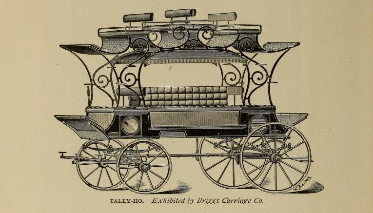
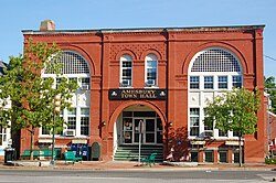
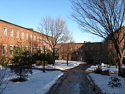
The Briggs Carriage Company is a historic industrial complex at 14 and 20 Cedar Street in Amesbury, Massachusetts. Built before 1890, these two buildings are a surviving reminder of the city's late 19th century prominence as a major carriage manufacturing center. They were listed on the National Register of Historic Places in 2007.
Gallery


Sponsored
Location
1 explorer visited this place
408 m
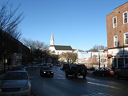
Amesbury is a city in Essex County, Massachusetts, United States, located on the left bank of the Merrimack River near its mouth, upstream from Salisbury and across the river from Newburyport and West Newbury. The population was 17,366 at the 2020 United States census. A former farming and mill town, Amesbury is today largely residential. It is one of the two northernmost towns in Massachusetts.
485 m
The Amesbury and Salisbury Mills Village Historic District is a historic district on Market Sq. roughly bounded by Boardman, Water, Main and Pond Streets in Amesbury, Massachusetts. It was the site of significant industrial development between 1800 and 1875, during which time the town developed a significant textile processing industry. Among the buildings in the district is the Salisbury Mill #4, a four-story brick Greek Revival building which features dentil decorations on its eaves and towers.
The district was listed on the National Register of Historic Places in 1985.
587 m
Amesbury CDP was a census-designated place comprising the main urban portions of the city of Amesbury, Massachusetts, in Essex County. With the change of Amesbury's status from town to city in 1996, the delineation of the downtown area as a CDP became unnecessary, and it was no longer used for data collection by the time of the 2010 census.
Those details reported here are also included in the aggregate values reported for the entire city; at the 2000 census, the CDP had a total population of 12,327.

650 m
The Back River is a 6.5-mile-long river located in New Hampshire and Massachusetts in the United States. It is a tributary to the Powwow River, part of the Merrimack River watershed. Approximately 3.0 miles of the river are in New Hampshire, with the remaining 3.5 miles in Massachusetts.
Prior to European settlement in the early 17th century, Native Americans of the Pennacook tribe lived in the area, and used both the Back River and parent Powwow River for transportation and fishing. The native population was essentially destroyed by the 1617-19 epidemic in the area.
In the 1950s, the Clarks Pond Dam was built in Amesbury, Massachusetts, creating the pond of that name. Since the pond's creation, it has been degraded by residential building in the area, and was considered "threatened" in a 2013 report, by residential run-off and silt deposits.
The Back River rises in Kensington, New Hampshire, and flows southeast, almost immediately entering the town of South Hampton. The river turns south and enters Massachusetts in Amesbury, joining the Powwow River at tidewater just downstream from the city's center at the falls of the Powwow.

722 m
St. James Episcopal Church is an historic parish in Amesbury, Massachusetts.
Book your tour near
Briggs Carriage Company
Book Now
4.0
in partnership with
GetYourGuide.com